 |
| The mouth of Drakes Estero with the tip of the Pastoral Lands in the background |
Sunsets are a common theme among visitors to the Californian coast. The
Sunset Trail on Angel Island, for example, offers great views of the Golden Gate—and chances of a golden sunset to be watched after the last ferry for the day has left. Further north at
Point Reyes there is a
Sunset Beach Trail. This dead-end trail through grassland to rocky
Sunset Beach west of
Drakes Head follows the coastline of
Drakes Estero. South of Sunset Beach Drakes Estero joins
Estero de Limantour. Together these two marshy estuaries meet
Drakes Bay.
 |
| Coastal gum plant next to Sunset Beach Trail |
You will start out on
Estero Trail, which traverses a pine forest, crosses
Home Bay along a narrow isthmus and then leads southwest, up and down over undulations. Once you are getting to the junction where a trail leads eastward over the
Drakes Headland, you will have arrived at the beginning of Sunset Beach Trail, which continues above Drakes Estero's eastern shores. While scanning the bay for marine mammals and seabirds, also watch out for deer and free range cattle.
 |
| Home Bay crabs: becoming bat ray diet at high tide? |
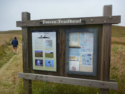
The Estero Trailhead kiosk informs visitors that bat rays are common in Drakes Estero, which—along with Tomales Bays and Bolinas Bay—serve as nursery and feeding spots. Maybe you have noticed some crabs crawling around while walking along the Home Bay isthmus. These crabs are part of the bat ray diet. But the bat rays forage on other invertebates as well. Most of the muddy bottom of Home and Estero Bay is exposed to air and to your views at low tide. I am wondering if rays can be spotted with binoculars from Sunset Trail at high tide, when the muddy floor is submerged by enough water to accommodate bat ray movement and their foraging activities?
 |
| Sunset Beach Trail coming down to sea level |
The final section of Sunset Beach Trail drops toward a coastal lagoon. Across a narrow isthmus, you should be able to see the tip of the
Pastoral Lands (top picture) and
Chimney Rock further out, unless coastal fog is moving in and between. The intertidal zone at Sunset Beach is teeming with life. Animals typical for such saltwater pool habitats—including sea stars, urchins, barnacles and anemones—can be observed.
 |
| Estero Trailhead kiosk |
Getting to the Sunset Beach Trail
From the
Bear_Valley_Visitor_Center at
Point Reyes National Seashore (see
park map) head north on Bear Valley Road to its junction with
Sir Francis Drake Boulevard (
SFD Blvd.). Follow SFD Blvd. to Inverness and continue on. SFD Blvd. eventually turns left (west). Pass its junction with Pierce Point Road and Mount Vision Road. Then turn right where a sign gives direction toward the Estero Trailhead. Find trailhead parking after about one mile.The hiking distance between the trailhead and Sunset Beach is about 4.5 miles. Plan for a round trip of nine or more miles, including estero and beach side steps.


No comments:
Post a Comment