Friday, October 27, 2017

Majestic Oaks Trail: a short trail through the oak forest of Caswell Memorial State Park

Oak forest of  Caswell MSP in California's Central Valley
Oak forest of Caswell Memorial State Park in California's Central Valley

Majestic Oaks Trail is a short hiking trail through dense oak forest. This less-than-a-half-mile-long trail connects with Fenceline Trail and Gray Fox Trail and intersects with River Bend Trail in Caswell Memorial State Park, California. Some of the majestic valley oak trees in the park are said to be more than 60 feet tall and can have a circumference of up to 17 feet. Wild grapevine is taking over the underbrush—and in many places is trying to reach for the higher branchwork as well.

The spreading oak forest canopy is amazing. You are in an oak jungle. To appreciate the size of a single valley oak, see the broad-crowned oak tree in the Cosumnes River Preserve, another small Central Valley park, in which old valley oak trees are preserved and new ones are planted to keep the Valley alive with valley oak.

Monday, October 23, 2017

Caswell Memorial State Park: shaded trails through an ancient forest

Wild grapevine drapings in Caswell Memorial State Park
Caswell Memorial State Park is a preserve of riparian woodland six miles southwest of the city of Ripon in San Joaquin County in California's Central Valley. The east- and south-side boundary of the park is the meandering Stanislaus River with its bends and sand beaches.

Grapevine branches hanging over Gray Fox Trail
The riverside park stands as an example for a mature oak riparian forests; now rare, but once much more prominent in the valley landscape. The most striking feature of the park is the ancient forest —actually, most of the preserve consists of dense forest. Tall oak and cottonwood trees grow here, many of which have been conquered by wild grapevines with hanging and swinging branches. Numerous shaded trails loop around interesting forest sites and some provide access to vista points alongside the Stanislaus River.

Stanislaus River
River Bend Trail vista: Stanislaus River at river bend
The riparian ecosystem is teeming with wildlife. Racoons, foxes, skunks, weasels and squirrels live here. The smaller riparian brush rabbits and riparian wood rats have their burrows or nests in the thick understory—hidden, but still not completely safe from predators. Jordan Summers writes about these small mammals [1]:

Sitting at the bottom of the food chain, they are meals for raptors such as great horned owls, osprey, and Swainson's hawks; they are also on the menu of all the mammals listed above; and they are even taken by snakes. No wonder they live in seclusion.


Park history

The plaque at the park entrance says that Caswell Memorial State Park was donated in memory of Thomas Caswell (1843-1921), early day rancher and humanitarian, and his sons Wallace Caswell and Henry Caswell. The park brochure shows a picture of Thomas Caswell on his Modesto ranch and provides further details:

Seven hundred acres [2.833 km2] of riparian forest along the river were purchased by Thomas Caswell, a farm equipment manufacturer and rancher, in 1915. In 1950 the Caswell family created a legacy for the people of California by donating 134 acres [0.542 km2] of forest to be preserved as a state park, so future generations might experience the valley in its original natural state.


Getting to Caswell MSP

The park address is: Caswell Memorial State Park, 28000 South Austin Road, Ripon, CA 95366. Phone: (209) 599-3810.
From downtown Ripon head west on West Ripon Road. Turn left on Austin Road and drive south. The road leads into the state park. An entry fee has to be paid at the kiosk. After continuing for less than half a mile on the shaded road to its dead-end, the parking lot, rest rooms and picnic tables are found on the left side.


References and more to explore

[1] Jordan Summers: 60 Hikes within 60 Miles, Sacramento. Menasha Ridge Press, Birmingham, AL, 2008.
[2] Caswell Memorial State Park. Links: Website and Park Brochure.
[3] Campground map of Caswell Memorial State Park. Link: https://www.parks.ca.gov/pages/557/files/CaswellMemorialSP_CampMap021015.pdf.

Saturday, October 21, 2017

River Walk Trail in Cosumnes River Preserve

Cosumnes River
Cosumnes River, Central Valley, California
The Cosumnes River Walk in the Cosumnes River Preserve includes trails along the Middle Slough and loop trails with access to the Cosumnes River. The trails will lead you through grasslands and riparian forest. You are invited to combine various trail loops into your overall path. If you are headed to what is called “The Point”—a scenic place from where you can see the Cosumnes River and the entrance to Tihuechemne Slough— your round trip will be at least three miles long. A Nature Trail Guide with a trail map is available at the visitor center

From the preserve's visitor center your walk will start like the Wetlands Walk over the bridge with the beautiful, often overlooked plaque illustrations of animals and plants. Instead of turning left for the Wetlands Walk, turn right to stroll south alongside Middle Slough. The water in the slough may look stagnant, but, since it is connected with San Francisco Bay via the Delta waterways, it has a slow in-and-out flow: Middle Slough is a tidal slough influenced by the bay tides.

The Guide features many points of interest including the majestic valley oak, growing in the oak savannah to the left of the tracks of the Union Pacific Railroad. You'll find a variety of other plants such as live oak (less common to the preserve), willow, native and non-native blackberry, wild California rose, Santa Barbara sedge, cattails—and, yes, poison oak.

Santa Barbara sedge
Long, flat, green blades of Santa Barbara sedge

poison oak
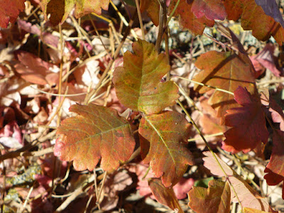
Leaves of three, let it be!
Alongside the Cosumnes River you will find a few points with small openings in the riparian forest enabling riverside bird-watching. Seasonally, great blue herons and egrets roost and feed here. The visitor center handout with the title Cosumnes River Preserve describes the origin of the eponymous river as follows:
Just over 80 miles long, the Cosumnes River begins in the great Sierra Nevada mountains, deep in El Dorado National Forest. Its head waters rest at an elevation of 7,600 feet and the river is fueled mostly by rain runoff and some snowmelt. The three forks of the Cosumnes flow through lush conifer forests and tumble over the huge rocks of granite canyons. As the river drops into the drier foothill environment, it coalesces into one channel. Oaks and gray pines dominate the landscape.

In the Central Valley the river slows its flow and feeds the aquifer below. Less than a mile away from the preserve's slough and river trails, the water of the Cosumnes River joins that of the Mokelumne River on its way into San Francisco Bay.


Tihuechemne Slough/Cosumnes River junction


Friday, October 20, 2017

Wetlands Walk Trail in Cosumnes River Preserve

Potato-shaped gall growing on valley oak tree
Wood duck illustration on bridge plaque
At the north side of the visitor center of Cosumnes River Preserve is the trailhead for the Cosumnes River Walk and the Wetlands Walk Trail. A bridge with metal plaques on its handrails, illustrating local animals and plants, crosses Willow Slough. Turn left when you get to the open land with rail tracks in view.

Bridge over Willow Slough
Turn left again at the next junction, from where another bridge (see picture) takes you across Willow Slough to an “orchard” of valley oaks: these trees were planted by preserve volunteers in 1988. They are much younger and smaller than the majestic valley oak you will encounter while exploring the River Walk Trail farther south.

At the branches of some oak trees you will notice yellowish brown or dark brown galls—often ball-shaped, occasionally potato-shaped like the one shown above. They develop when wasps lay their eggs in the bark. I saw  numerous valley oak trees with dense clusters of galls. Judging by tree appearance they do not harm the growth or well-doing of the trees.   

The valley oak trees populate most of the area north of the slough between the railroad tracks and Franklin Boulevard. The trail loop intersects with Franklin Boulevard and continues southwest toward the boardwalk and back to the visitor center. At the end of the half-mile-long boardwalk you will find a viewing platform. Wildlife viewing here is most interesting when the ponds are flooded and the area turns into wetland, providing opportunities to see ducks, geese, swans and shorebirds. Wading birds such as ashy gray sandhill cranes with their bare red-topped heads roost in the ponds of the preserve. The significance of the preserve as a crane stop is highlighted by featuring them in the Cosumnes River Preserve logo and in the crane sculpture in front of the visitor center.  

Boardwalk with viewing platform during the dry season

Sunday, October 15, 2017

Cosumnes River Preserve

Cosumnes River Preserve sign next to Franklin Boulevard

Cosumnes River Preserve logo
The Cosumnes River Preserve is a valley oak and wetland preserve in California's Central Valley [1-4]. About 90% of the original grasslands and wetlands in the Central Valley have been lost by conversion mostly to agricultural land. At a preserve kiosk you will find the interesting information that there were times when one could travel by boat all the way from Sacramento to Bakersfield. Efforts are now taken to enlarge preserved areas and restore others to ensure lasting water supply, support migratory birds on the Pacific Flyway and generally benefit recreation and agriculture.

Middle Slough
Within the Cosumnes River Preserve hikers and birders can experience wetland habitat and a band of riparian oak forest turning into oak tree savanna with increasing distance from the Cosumnes river and adjacent sloughs. Boardwalks, interpretive panels, various loop trails and occasional benches invite visitors to stroll, hike and picnic at a scenic point. My favorite spot is the tree site with the majestic valley oak (marker 22 at the River Walk Trail). Paddlers will enjoy the free-flowing, forest-lined river.
  
Cosumnes River
As the Cosumnes River Preserve signshown in the top picture—indicates, this nature preserve is the result of a dedicated conservation partnership. Jordan Summers writes (page 90 in in [1]): “The Cosumnes River Preserve is managed by the Nature Conservancy, the U.S. Bureau of Land Management, Ducks Unlimited, the California Department of Fish and Game, the State Lands Commission, the California Department of Water Resources, Sacramento County, and private landowners.” Indeed a diverse partnership highlighting the importance and many interests in preserving wetland resources.


Getting to the Cosumnes River Preserve visitor center and trailheads

The preserve is located about twenty miles south from Sacramento. From Interstate 5 take the Twin Cities Road exit and turn left on Twin Cities Road. Continue east for about one mile, then turn right on Franklin Boulevard and go south. After passing the Cosumnes River Preserve sign continue for another mile to find parking space and the visitor center at 13501 Franklin Blvd. on the left. No fees or permits. The trails start on the left side of the visitor center. Half-way between the Cosumnes River Preserve sign and the visitor center is another parking area off Franklin Blvd. to do the Lost Slough Wetlands Walk. If your goal is the Cosumnes River Walk, you want to start at the visitor center trailhead, cross the bridge and then turn right to walk south alongside Middle Slough. This path guides you to the loops with Cosumnes River views and access on both sides of the railroad tracks.

References and more to explore

[1] Cosumnes River Preserve Trails in “60 Hikes within 60 Miles, Sacramento” by Jordan Summers. Menasha Ridge Press, Birmingham, AL, 2008.
[2] Sacramento County Regional Parks: Consumnes River Preserve. Link: www.regionalparks.saccounty.net/Parks/OpenSpaces/Pages/CosumnesRiverPreserve.aspx.
[3] The Nature Conservancy: California > Cosumnes River. Link: www.nature.org/ourinitiatives/regions/northamerica/unitedstates/california/placesweprotect/cosumnes-river.xml.
[4] BirdWatching: Cosumnes River Preserve, Galt, California. Link: www.birdwatchingdaily.com/hotspots/30-cosumnes-river-preserve-galt-california/.

Sunday, October 8, 2017

A coiled, tongue-flicking rattlesnake

Coiled rattlesnake showing her split tongue
Coiled rattlesnake throwing its forked tongue
Rattlesnake's split tongue
I've run into quite a few rattlers in the Reno-Tahoe area, mostly at lower elevation in the non-forested brush landscape. Always, I had been warned by the distinctive rattle buzz, before I saw the reptile body. Recently I had a near miss. I came close to a coiled rattlesnake that was hiding behind a low bush on Halo Trail west of Keystone Canyon in the Peavine foothills north of Reno. She (or was it a he?) warned me just in time. Maybe she was as surprised as I was. Maybe he was at high alert since mountain bikers were speeding past her trailside hangout a few minutes earlier.

When I heard that one-of-a-kind rattling—about four feet away—I froze and immediately stepped backwards. I continued to slowly move backwards without turning around, so I could watch. The rattler undulated a short distance away from the trail; then coiled up again. This was when I took pictures like the one above—keeping a safe distance. She started rattling in intervals and kept flicking the forked tongue in and out. Saliva was dripping. I remember being told once that rattlesnakes were believed to lick their prey all over to facilitate swallowing it, but this now being considered a myth. Certain rattlesnake behavior may be shrouded in myth. But rattlesnakes are real—from tongue to tail.   

Rattlesnake's rattle