Saturday, October 30, 2021

Rock & boulder hiking in the Lynn Woods Reservation: from Dungeon Rock to Balanced Boulder

A pond with boulders next to Boulder Path in the Lynn Woods Reservation 
The Lynn Woods Reservation is the second largest municipal park in the greater Boston area. It makes up a fifth of the area (about 2,200 acres) of the City of Lynn north of Boston. The park is roughly divided into equally sized areas north and south of the Walden Pond reservoir.  Both sides are crisscrossed by multiple trails along which you can explore points of historical and geological interest. The handout map contains the following administrative information:

Founded in 1881, Lynn Woods Reservation, is a 2,200-acre municipal forest park located in Lynn, Massachusetts. The City of Lynn's Department of Public Works, Park Commission, and Lynn Water & Sewer Commission share jurisdiction and management of Lynn Woods Reservation. The park encompasses nearly one-fifth of the entire land area of the city and represents a significant natural, watershed, and public recreational resource in eastern Massachusetts.

Beyond dog walking and hiking, the recreational activities in the park include mountain biking and bouldering. Early this fall, I hiked from the Pennybrook Road Entrance to the Balanced Boulder on mostly single-track trails including Jackson Path, Boulder Path, Richardson Pathway, Comel Path and Overlook Trail. I found this to be an apt sequence of trails alongside which one can get an impressive overview of the park's rocks, boulders and crags.

Starting at the Pennybrook Road Entrance, it just takes a short walk on Jackson Path to get to Dungeon Rock and nearby Union Rock.

Upstairs to the Dungeon Rock formation
Continuing northwest on Dungeon Road and soon turning right on Cooke Road leads to the south-end Boulder Path junction. The shallow pond shown in the top picture is on the left side of Boulder Path.

Boulder Path
After about half a mile this path meets Cooke Road again. A very short climb took me to the Stone Tower on top of Burrill Hill. Here, the Richardson Pathway intersects with Cooke Road. The Walden Pond reservoir is located north of Burrill Hill. To get around the southeast tip of the reservoir, I hiked Richardson Pathway downhill (east of the Stone Tower), turned left at its junction with Comel Path and shortly, at the end of this path, right on Great Woods Road

Boulder assembly next to Richardson Pathway
At the reservoir tip, I turned left on Ox Pasture Road, which I followed for half a mile along the lake to the point where the Overlook Trail splits off to the left. This trail continues over rocky terrain, still relatively close to Walden Pond, but which often was not visible through the forest or intersecting rock formations. Around Overlook Crag I tried different rock plateaus for varying, but never complete views of the extending body of water.  

Overlook Crag: view of parts of Walden Pond
Northwest of Overlook Crag, the trail winds slightly away from the reservoir, continuing to the Great Frog Boulder and the Balanced Boulder.
Great Frog Boulder


Balanced Boulder

References and more to explore

[1] Map: Lynn Woods Reservation. URL: http://www.cityoflynnoecd.net/documents/resource/maps/Lynn_Woods_2009-01-20.pdf. Note: this map is also provided at certain Lynn Woods trailheads such as the Pennybrook Road Entrance.

[2] Welcome to the Lynn Woods Reservation. City of Lynn. URL: http://www.lynnma.gov/departments/lynnwoods.shtml

[3] Kiley Jacques. A Visit to Lynn Woods Reservation. Northshore Magazine. May 2, 2016. URL: https://www.nshoremag.com/faces-places/a-visit-to-lynn-woods-reservation/.

[4] Peyton Moreno. The Role of Friends of Lynn Woods. Friends of Lynn Woods. November 2, 2020.  URL: http://www.lynnwoods.org/.


Unnamed boulder next to Overlook Trail


Wednesday, September 29, 2021

Around Cape Cod's High Head

Know your risk at High Head Beach and anywhere else around Cape Cod: October is peak month.
The High Head area in Truro on Cape Cod features various recreational as well as historically and geologically interesting sites. It is accessible via High Head Road and Pigrim Heights Road.

Zooming into bear oak shrub next to Pilgrim Spring Trail
You will find both roads in North Truro on the east side of Route 6.  Driving north, the Pilgrim Heights Road exit comes first. At its end, you will see a pavilion, where the trailheads of the Pilgrim Spring Trail and the Small's Swamp Trail are located. Both trails loop up and down through pine and oak shrub forest to High Head vista points that offer scenic views of the Outer Cape, including salt meadows and a sand dune range, which merges with the Parabolic Dunes landscape to the northwest. 

At High Head Road's dirt parking lot begins (or ends) the Head of the Meadow Bicycle Trail. This paved, two-mile-long, multi-use trail winds along between forested hillsides and marshland to its other access point at Head of the Meadow Road

Bike Trail Map at trailhead
 
Head of the Meadow Bicycle Trail


From the bicycle trailhead, High Head Road continues as an Off Road Vehicle Route to High Head Beach. A current National Park Oversand Permit is required. The shark warning sign (top picture) at the beginning of the dirt road can't be overlooked. Once in a while, visitors spot a shark. Most certainly, you will be able to watch large numbers of sea birds and seals. You can explore miles and miles of beach sand and ocean surf while walking all the way north to Dune Shacks Beach & Trail—a long stretch where to find intertidal surprises and solitude.

Where there are seals, there may be sharks.


Big Head/Pilgrim Heights is located on Cape Cod's forearm east ofProvince Lands Fist


References and more to explore

Cape Cod trail maps. The second map in the following PDF file shows the bike trail between High Head Rd. and Head of the Meadow Rd.: https://www.capecodbikeguide.com/pdf/cape-cod-provincelands-trail-map.pdf.

Pilgrim Heights and High Head sites - North Truro. National Park Service, Cape Cod. URL: https://www.nps.gov/caco/learn/historyculture/pilgrim-heights-and-high-head-sites-north-truro.htm.  

Head of the Meadow Bike Trail. National Park Service, Cape Cod. URL: https://www.nps.gov/caco/planyourvisit/hombiketrail.htm.


East Harbor (Pilgrim Lake)


Sunday, September 26, 2021

Pilgrim Spring Trail, Cape Cod

Pilgrim Spring Trail
Pilgrim Spring Trail is a short interpretive loop trail through pitch pine and bear oak forest. Like its neighbor loop trail, Small's Swamp Trail, it leads to a scenic vista point and features some posts highlighting selected native plants alongside its path. The sand dunes between Pilgrim Heights and the Atlantic Ocean—and the area of parabolic dunes farther north—define the coastal landscape of the Outer Cape at North Truro.

Outer Cape with dunes and North Atlantic seen from a Pilgrim Spring Trail vista point

Acorns of Bear Oak (Quercus ilicifolia, beech family) with their saucer-shaped, reddish-brown cup covering about half the nut
Pilgrim Spring Trail also connects with the paved Head of the Meadow Bicycle Trail. At the connection point, you will find a historic marker and an interpretive panel.
Pilgrim Spring Trail/bicycle path connection with historic marker and interpretive panel

Historic marker
The marker titled First Spring quotes from a Pilgrim text. Probably somewhere around this place, a group of fresh-off-the-boat Pilgrims (Mayflower passengers) “saw a deere, and found springs of fresh water, of which we were heartily glad and sat us downe and drunke our first New England water.”   

The panel provides more details about the Mayflower Pilgrims and their need for water and food:

After 66 days traveling across the stormy North Atlantic, Mayflower passengers finally spotted land—the sand cliffs of Cape Cod—on the morning of November 9, 1620. Once the Mayflower was safely anchored in the natural harbor near present-day Provincetown, the Pilgrims now faced the task of establishing a permanent settlement in an unknown land.

In great need of fresh water, food, and firewood, they set out on three “discovery” expeditions over the course of several weeks. 

 Near this location Myles Standish and his expedition of 16 men had their first taste of  fresh New England water. It was as pleasant to them, William Bradford reported, “as wine or beer.” While it's unclear if this is the exact location of that first drink in 1620, this natural spring closely matches the setting and descriptions left by the Pilgrims during initial explorations of their new world. 

The Pilgrims also found and ate food that Native People had stored. On the third expedition, they had their first interaction with the Native People, which ended with an exchange of arrows and gunfire. Unease over the encounter and the inhospitable environment of Cape Cod led the Pilgrims to sail onward to Plymouth, where they settled.


Getting there

Exit Route 6 at Pilgrim Heights and drive to the end of Pilgrim Heights Road to find parking near the interpretive shelter.
Map of Pilgrim Heights area
The straight red line in the lower left corner of the map is Route 6. The green line is the Head of the Meadow Bicycle Trail. The area above the bike trail line is called Salt Meadow.

Saturday, September 25, 2021

Up and down the hills through moist, near-ocean woodland: Small's Swamp Trail, Cape Cod

View from Small's Swamp Trail: swamp, sand dune range and Atlantic Ocean
Small's Swamp Nature Trail or Small's Swamp Loop Trail—I will use the short form Small's Swamp Trail in the following—is located on “Cape Cod's forearm” (remember, Cape Tip to the northwest is nicknamed “Province Lands Fist”). Geo-anatomical nicknaming aside: this trail features some amazing vista points to scan the Atlantic Ocean, nearby swamps and sand dunes. It leads around the former farm land of Thomas Small, after whom the trail is named. 

Up the hill via log steps to a vista point
Small's Swamp Trail—a three-fourths mile loop trail—takes you up and down rolling sandhills with a mixed forest of pines, scrub oak and shrubs. Halfway around the loop, you will find a short connector path to the paved Head of the Meadow Bicycle Trail. A neighbor loop trail, Pilgrim Spring Trail shares its trailhead with Small's Swamp Trail and also connects with the bicycle trail.

Alongside Small's Swamp Trail you will find selected plants that are identified by a marker on a post providing the common and scientific name plus a drawing and the plant family to which the species belongs. The list of marked plants include black oak, bear oak, sweet pepperbush, highbush blueberry, beach plum, black cherry, bear berry, bayberry, wild sarsaparilla and poison ivy.


Bayberry (Myrica pensylvanica), Waxmyrtle Family

Wild Sarsaparilla (Aralia nudicaulis), Ginseng Family


Getting there

Small's Swamp Trail and its neighbor loop trail, Pilgrim Spring Trail, are in the Pilgrim Heights Area of the Cape Cod National Seashore. The trailhead for both trails is located next to the parking-lot loop at the end of Pilgrim Heights Road. Access this road by exiting Route 6 at Pilgrim Heights. See map.

The trailhead is next to the interpretive shelter. There you also can find some information on the history of the Mayflower Pilgrims, who, after nine weeks of crossing the North Atlantic, spotted the sand cliffs of Cape Cod. The Mayflower anchored in present-day Provincetown. After five weeks, the Pilgrims sailed across Cape Cod Bay to where now is Plymouth.


Grassy trail section


References and more to explore

Small's Swamp Trail. National Park Service, Cape Cod, National Seashore Massachusetts. URL: https://www.nps.gov/caco/planyourvisit/smallsswamp.htm.

Small's Swamp Trail. National Park Planner. URL: https://npplan.com/parks-by-state/massachusetts-national-parks/cape-cod-national-seashore-park-at-a-glance/cape-cod-national-seashore-hiking-trails/cape-cod-national-seashore-smalls-swamp-trail/.

Hike Cape Cod. Pilgrim Springs - Small's Swamp Trails, Truro MA. Blogspot post, August 13, 2011. URL: http://hikecapecod.blogspot.com/2011/08/pilgrim-springs-smalls-swamp-trails.html.


Friday, September 24, 2021

From Provincetown to the Dune Shacks and the Parabolic Dunes

Parabolic Dunes area with the Pilgrim Monument far back on the the left side—seen from a dune at High Head Beach on September 11, 2021
The National Park Service map of the Cape Cod National Seashore shows a Parabolic Dunes area between East Harbor (North Truro) and the Atlantic Ocean, which stretches roughly from the Dune Shacks Trail to Pilgrim Heights. Although the parabolic dunes can be reached by car via High Head Road off Route 6 in Truro, I decided to get there by hiking from Provincetown via the Old Colony Railroad Trail, Dune Shacks Trail and the seashore beaches. This year—after all the summer rain—I found the Dune Shacks Trail partially flooded along its sections between the dunes.  

Dune shack seen from Dune Shacks Trail 

Outer Cape: Dune Shacks Beach narrowing and bending southeast towards High Head Beach
This is a great day trip. Half of the way—from Dune Shacks Beach across secluded beaches to High Head Beach—goes alongside ocean surf. I enjoyed this part by wading and sea-life watching

Seals in the surf between Dune Shacks Beach and High Head Beach
You may want to check the tide table before going, since along certain stretches you may find it difficult, if not impossible, to escape from strong high-tide waves over the steep, cliff-like front dunes. Also, some beach sections are closed off from early March to mid-August to accommodate shorebird nesting.    

So, where are the parabolic sand dunes? And how do I identify one? I surfed the web beforehand.

I found a cool, downloadable document on the NASA Earth Observatory site describing various sand dune types for kids [1]. If it has been written for kids, it can't be wrong for adults. Since my dune knowledge is not on firm ground, I used this file to get started. Parabolic dunes are introduced as follows: 

Parabolic dunes typically form near the ocean on sandy beaches with some vegetation. Beach grasses and plants anchor the tips of the dunes, and the wind blows out the center. This forms crescent-shaped dunes with tips facing into the wind.

The tips are also called horns. A Wikipedia schematic illustration shows coastal parabolic dunes with their steep windward side facing the ocean surf and the leeward slip-face facing away from the ocean [2].

There is a characteristic dune at High Head Beach. I already noticed it from farther away, while approaching this sandy beach, which has been said to provide an off-the-beaten-path experience and is praised as a spectacular beach for fishing, wildlife watching and relaxing in the golden sand [3]. Spotting and identifying parabolic dunes is not mentioned. I tried anyway. 

The dune I approached is shown in the picture below.

Slightly crescent-shaped dune at High Head Beach with tips (horns) a little closer to the waterfront than the upper crest

This crescent-shaped dune has a steep and barren front including the sand-only blow-out area. The steep side is facing the Atlantic Ocean. The crest and slip-face is covered with dune grass. Is it a typical parabolic dune? Is it in its early stage? Since dunes reshape and move over time, any label is just a snapshot classification. This makes sandy scapes so interesting. Indeed, windblown shapes are mind-blowing—whether parabolic or othercurved.

References and more to explore

[1] Shifting shapes of sandy scapes. NASA Earth Observatory, August 2020. URL: https://earthobservatory.nasa.gov/blogs/eokids/shifting-shapes-of-sandy-scapes/. Note: the link to download the PDF document is right below the first picture.

[2] Schematic of coastal parabolic dunes. Wikipedia. URL: https://en.wikipedia.org/wiki/Dune#/media/File:Parabolic_dune.jpg.

[3] Kinlin Grover: High Head Beach: North Truro's Hidden Gem. The Beach Times - Kinlin Grover Vacation Rentals, April 7, 2021. URL: https://www.vacationcapecod.com/blog/high-head-beach-north-truros-hidden-gem.


Sunday, September 12, 2021

New England's record-breaking wet summer: hiking partially flooded Dune Shacks Trail gives an impression

Dune Shacks Trail under fresh water, where the beach and salt water of the Atlancic Ocean is just a dune away
Massachusetts is approaching records for the wettest summer to date [1]. On Cape Cod, I found the Dune Shacks Trail partially flooded this year, while hiking from Provincetown to the Dune Shacks Beach on September 11, 2021. Doing the same trip at the end of September last year, the Dune Shacks area was completely dry—desert-like, the trail a sandy path. This year, it was a coastal-dune and bogs experience.
Dune Shacks Trail scenery after late-summer rain
Plant communities here have adopted to tolerate hot and dry, and sometimes salty, conditions [2]. Along the trail between the dunes, I found shallow accumulations of red-brown water of various size with thriving shrubs. Like other hikers, I was delighted seeing the masses of dense, creeping cranberry plants (Heath family). Often half under water, the yellow-to-red berries, ripening at the upper stem, were reflected in the water. Some berries were floating or even drowned. 

Cranberries hugging the water surface

Cranberries over sand

A bayberry shrub backdropped by a puddle of water with cranberries


View from under a pine tree: color pattern of water on sand

References and further reading

[1] Cassie McGrath: Massachusetts may break record for wettest summer, a hallmark of climate change, experts sayMASS LIVE. Aug. 25, 2021. URL: https://www.masslive.com/weather/2021/08/massachusetts-may-break-record-for-wettest-summer-a-hallmark-of-climate-change-experts-say.html.

[2] Sand Dunes. National Park Service, Cape Cod. URL: https://www.nps.gov/caco/learn/nature/sand-dunes.htm.


Dune Shacks Trail under rain water turning brown and pink 


Friday, August 27, 2021

Ipswich open space: Nichols Field

Deer watching at Nichols Field
Nichols Field is a nature reserve located southwest from the point where the Labor In Vain Creek meets the Ipswich River

Butter-and-eggs flowers of the snapdragon family (native to Europe and Asia, introduced to North America)

Forest alongside Ipswich River

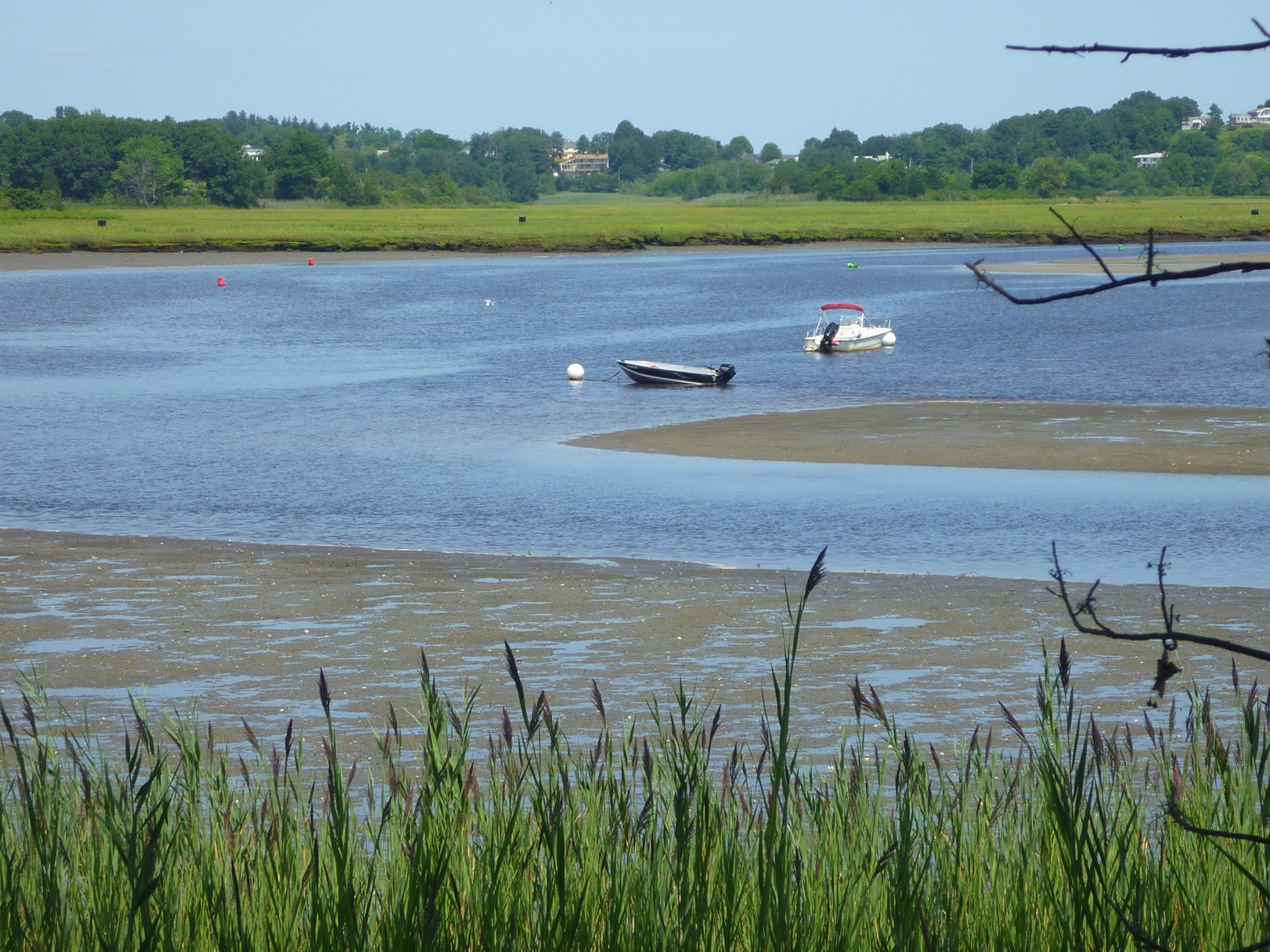
A loop trail, less than a half mile long, allows for a gentle hike around open grassland. Alongside the Ipswich River, you will find a stretch of forest. A short spur trail leads down to the shoreline of the Ipswich River and the Labor In Vain Creek.  Here, you can watch the river and marshland scenery with its boat traffic between Ipswich and Little Neck.  

Mud and marsh where the Labor in Vain Creek meets the Ipswich River

Near the trailhead, you will find a bronze plaque on a granite block that honors Ipswich resident Robert K. Weatherall, who volunteered for more than a decade as a Nichols Field land steward. 

Non-motorized and motorized traffic on Ipswich River seen from the forested river bank at Nichols Field


Address and map 

Nichols Field trailhead: 60 Labor in Vain Road, Ipswich, Essex County, Massachusetts 01938.

Map: https://ipswich.files.wordpress.com/2020/03/nichols-field-trail-map.pdf.


Grassy section of the Nichols Field loop trail


References and more to explore

Nichols Field - Ipswich - MA. Massachusetts Trails. URL: https://www.mass-trails.org/towns/Ipswich/nicholsfield.html.

Open Space. Historic Ipswich. On the Massachusetts North Shore. URL: https://historicipswich.org/ipswich-open-space/

Robert K. Weatherall Honored. Ipswich Massachusetts Bridging History. URL: https://www.ipswichma.gov/368/Robert-K-Weatherall-Honored.