 |
| One of the closest natural waterfalls to the city of Boston: Cascade Falls (seen on Nov. 14, 2021) |

The Cascade Trail marker is the upright yellow rectangle, which you will see fixed on trees. The hike from the trailhead to the cascade rocks (0.15 mile one-way) takes no longer than ten minutes.
The waterfall—called Cascade Falls or simply Cascade—is a combination of horsetails and plunges. The water source is the Shilly Shally Brook [1].
Getting to the trailhead

From Boston, take a train of the Orange Line to Oak Grove, which is the last stop on its northbound route. Walk north on Washington Street. After less than half a mile—at the Melrose Garden Triangle—turn left on Goodyear Ave [2]. This short road ends where the Cross Fells Trail and the Cascade Trail begin.
See the Friends of the Fells map for the Fells trail network [3]: find the Shilly Shally Brook and the Cascade in the lower left section above the Legend table.
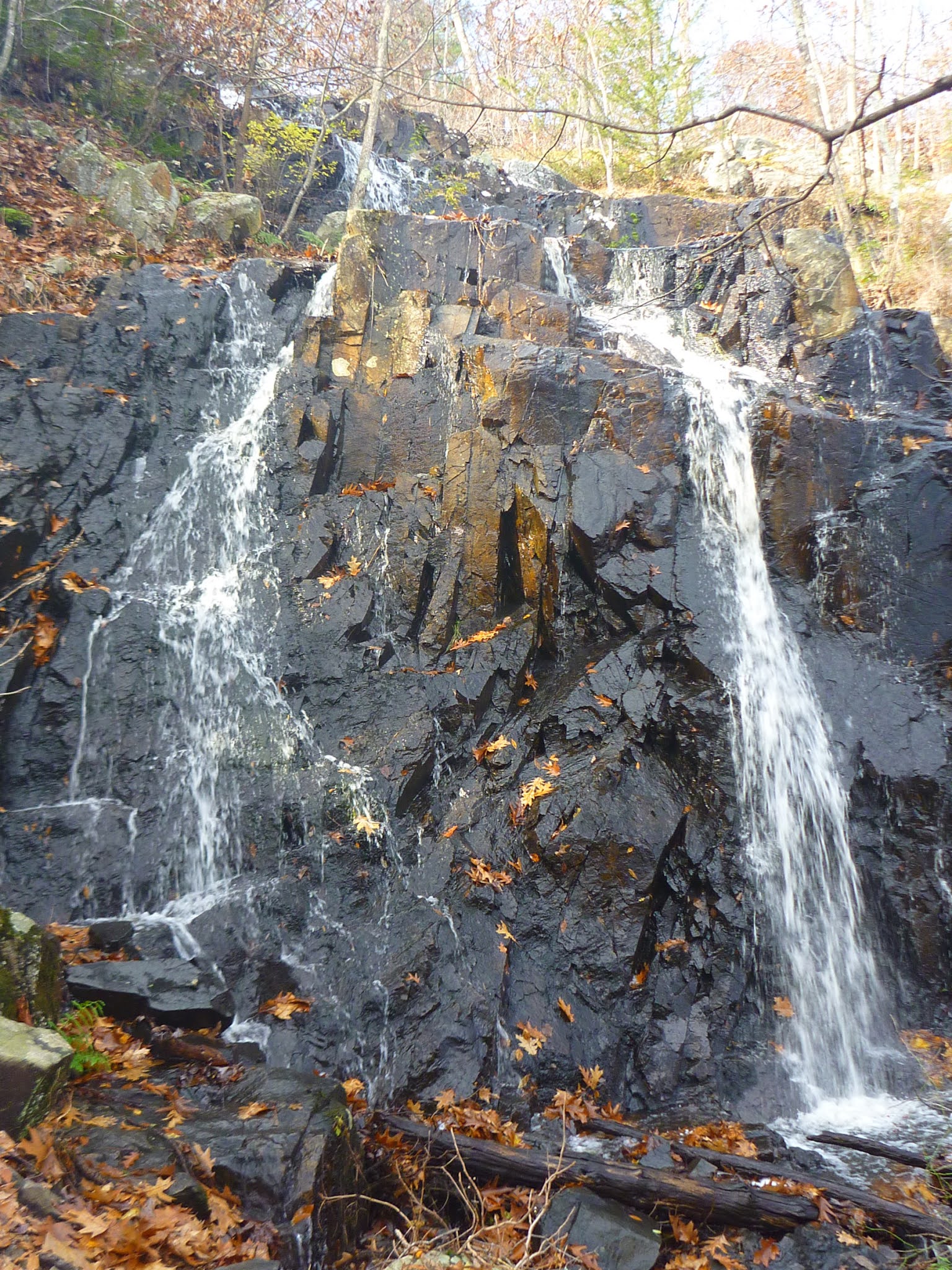 |
| A horsetail-type waterfall: Cascade Falls with two bottom horsetails on the day I was visiting (Nov. 14, 2021 - after a rainy night) |
References and more to explore
[1] The Cascade, Melrose, Massachusetts. New England Waterfalls. URL: https://newenglandwaterfalls.com/ma-thecascade-melrose.html.
[2] Best of Boston. The Cascade at Middlesex Fells Reservation. Boston Magazine. URL: https://www.bostonmagazine.com/best-of-boston-archive/2015/the-cascade-at-middlesex-fells-reservation/.
[3] Middlesex Fells Reservation Map: https://www.friendsofthefells.org/wp-content/uploads/2014/04/Fells_Reservation_Map.pdf.


No comments:
Post a Comment