Saturday, December 5, 2020

Herring River Trail: a short path following the Old Colony Railroad line

Herring River with remnants from the railroad past

The MBTA Greenbush station is the final stop of today's Greenbush line—the commuter rail line that connects Boston's South Station with Scituate and Greenbush. The line “runs on” southward as a walking and bicycling trail to the Herring River marshes by following the Old Colony Railroad bed. The trail ends at the north bank of the Herring River, but the railroad bed continues on the other side. From 1871 to 1938 the Old Colony Railroad was operating all the way to Marshfield. That service was terminated in 1938 when a hurricane severely damaged the tracks [1-3].

Herring River Trail with trees showing their fall colors (early November, 2020)

The Herring River Trail—also known as Herring Brook Trail [2]—begins next to Dunkin Donuts on Driftway. The paved Driftway Multi-Purpose Path links the Herring River Trail with the Driftway Conversation Park

Herring River Trail seen from its marsh section near the river

The first section of the half-mile-long Herring River trail is lined by trees on both sides, before the trail enters marshland. A few wooden railway ties scattered alongside the converted track remind us of the railroad past. Some remnants of what once was a bridge or viaduct can still be seen at the Herring River. 


References and more to explore

[1] Herring River Trail. North and South Rivers Watershed Association. Blog Post URL: https://www.nsrwa.org/listing/herring-river-trail/.

[2] Local Rail Trails. North and South Rivers Watershed Association. Blog Post URL: https://www.nsrwa.org/local-rail-trails/.

[3] The Abandoned Scituate to Marshfield railroad line. Video URL: https://www.youtube.com/watch?v=9YxVHX6lwX0.


Saturday, November 28, 2020

Scituate Town Trails in Driftway Park

Driftway Park dock with salt marsh and Herring River views

Driftway Park is located next to the Widow's Walk Golf Course about 1.5 miles south of Scituate Harbor between Boston and Plymouth in Massachusetts. The park features a boat launch, two Herring River docks, a lockout picnic area, memorial sites and a network of various short trails.

The trail system includes color-coded and social trails. A trail map can be downloaded here (URL given below). The map shows the color-coded trails and the enumerated trail intersection points.

A. J. McEachern Memorial Trail—green-coded on the map—is a loop trail connecting Lookout Hill at the park entrance with all other trails and also with the docks, from where you can enjoy views of the Herring River passing through the salt marsh.  
A. J. McEachern Memorial Trail

Memorial rock next to trail with the inscription “Till We Meet Again”

The 1600-ft-long Main Trail—yellow-coded—is the longest trail in the park. It leads across a sandy area and through forest to intersection point 6 at the forest/salt-marsh line, where a short loop trail allows you to check out the high-tide flood situation. There, a frequently wet and muddy social trail connects with the blue trail. The latter leads to the red trail and also back to the docks and park entrance. 

Main Trail traversing sandy area via two branches

Blue Trail

Getting to Driftway Park from the Greenbush MBTA station

Walk south on Old Driftway and turn left onto Driftway. The south side of this road has a pedestrian and bicycle path, which you want to follow eastward until getting to the right-side park entrance at Lookout Hill.

Trail map URL: https://www.scituatema.gov/sites/g/files/vyhlif3781/f/uploads/driftway_website.png.


Scituate Wind turbine seen from Main Trail between intersection points 5 and 6


Sunday, October 25, 2020

Hiking to Long Point, the place of a short-lived community

Breakwater dike to Long Point: Can you make out the tower of Wood End Light at the opposite end of the dike?

Long Point—a Cape Cod sandspit bordering Provincetown's harbor on its southwest side—has an interesting history. Long Point is the result of the “river of sand” (generically known as Longshore Sediment Transport [1]) flowing around Cape Tip. The fertile fishing waters surrounding the tip attracted fishermen, who created a village on Long Point in the first half of the 19th century. Starting with the first house built by John Atwood in 1818, a bustling community with a general store, bakery, post office, schoolhouse, six windmills, wharf and salt works developed [2]. When the offshore fish stock became exhausted and the salt works less profitable, decline began in the 1850's. Christopher Setterlund describes the final episode of the Long Point settlement [2]: 

The final chapter of Long Point's story as a viable community came in 1875. The wharf which had been a part of the former fishing village was given a second life. Originally built by John Atwood it became part of the Cap Cod Oil Works, established by Jonathan Cook. The company's purpose was to extract all that was usable from the carcasses of whales and fish. It was purchased by Lorenzo Richardson of Boston in 1885 after Cook's death. He would change the name to the Cap Cod Oil Company in 1889.

The remains of the Cap Cod Oil Works can still be found at the harbor-side beach. The settlers once came from Provincetown via the dunes of Race Point and Herring Cove Beach. Today, you have a shorter option: the breakwater separating West End Marsh from Provincetown Harbor. The one-mile-long dike connects Provincetown's Westend with the Wood End Light site.

Wood End Light with Cape Cod Bay seen as a blue sliver

The breakwater is not a resort promenade. Be prepared to manage unlevelled granite blocks with gaps in-between. Parts of the dike may be submerged at extreme high tide. On a calm, sunny day, however, it is a pleasure to carefully cross the breakwater while having varying views of the West End Marsh, spotting “breakwater lichen” between the dike rocks and watching water birds on either side.

South-facing patches of breakwater lichen

The sand dune land stretches for about one mile and a half from Wood End Light to Long Point Light. Both lighthouses feature square-based towers—in contrast to the round-shaped Race Point Lighthouse located farther northwest at the westernmost tip of Cape Cod. 

Long Point Light with Provincetown Harbor entrance

To make a Long Point walk short, you can opt for the Long Point Shuttle service taking you from Provincetown to the tip and beaches around the Long Point lighthouse. 

Travelers disembarking the Long Point Shuttle boat

Beach life near the Long Point lighthouse with Provincetown and the Pilgrim Monument in the background


References and more to explore

[1] Shifting Shorelines. Link: https://www.capecodextension.org/shiftingshorelines/.

[2] Christopher Setterlund. Hidden Cape Cod: A Village That Used to Exist in Provincetown. March 7, 2017. Link: https://www.capecod.com/lifestyle/hidden-cape-cod-a-village-that-used-to-exist-in-provincetown/.


Charles Darby Memorial Cross with a westward view across Long Point toward Wood End


Sunday, September 27, 2020

Dune Shacks Trail, Cape Cod

Dune Shacks Trail

Shoes left behind

The Dune Shacks trailhead is located at the intersection of Provincetown's Snail Road and Highway 6. After a short walk through forest, you will arrive at the point where a sand dune trail leads out of the forest up to a dune ridge. This is where people often leave their shoes behind. Even if you expect your hike to be easier without shoes, think twice on a sunny summer day, when the sand gets quite hot—and the water you are carrying along should be available for drinking, not for cooling your feet.


Dune trail with the Atlancic Ocean at the horizon

Follow the sand trail to the second ridge and you will reach a great vista point with views of the Dune Shacks area surrounded by Outer Cape Cod and the Atlantic Ocean at the horizon.

Trail winding through open pine forest: a dune shack can be seen in the far back

Continuing on the trail—up and down dunes—and then through a belt of low-growing pine trees, you are getting close to the ocean-front dunes with shacks on top and amazing views of the stunning sand beaches of Outer Cape Cod. 

Labyrinth of lower pine trees

An informative panel at the trailhead with the title “A grand place to be alone and undisturbed” summarizes the history of this interesting, inspiring dunescape:

This unmarked path leads through the unique landscape of the Dune Shacks of Peaked Hill Bars Historic District and on to the Atlantic Ocean. The dune shacks are part of Provincetown and Truro's rich history. The earliest shacks were built as temporary dwellings for the families of surfmen who were stationed at the Peaked Hill Bars Life-Saving Station. Some were built by the fishing community to provide shelter and stow gear. Noted American playwright Eugene O'Neill spent time in a shack in 1919. He later took up residence in the life-saving station after it was decommissioned by the U.S. Coast Guard. Over the decades, artists, writers, and those wishing to experience remote and rustic dune life have been inspired by this landscape and its solitude. The tradition continues. Today the shacks are still occupied by private citizens, and some are used by local non-profit organizations. You are invited to explore and develop your own personal connection to this special place.

Atlantic Ocean and beach view near the end of Dune Shacks Trail

On a nice day, you most likely will not find yourself alone while tracking the sand trail (which you are expected to do, to leave the ambient habitat undisturbed). Once at the beach, however, you may find solitude by strolling northwest or southest along the  “never-ending” shoreline. If you came from Provincetown via the Old Colony Nature Pathway you have—instead of returning the same way—the option to hike northwest to Race Point Beach and then find your way back using a section of the Province Lands Bicycle Trail Loop.


End of Dune Shacks Trail at Outer Cape Cod shoreline

Saturday, August 29, 2020

From Provincetown to Race Point Light

Race Point Lighthouse

The Race Point Light Station on Outer Cape Cod is located on a sand dune peninsula between Hatches Harbor and the Atlantic seaside where Massachusetts Bay continues southward as Cape Cod Bay. The site includes the preserved Race Point Lighthouse, the Keeper's house and a Whistle house

Race Point Light Historical Site
Lighthouse and Keeper's house

You may access the site via sand-dune tour with a four-wheel drive vehicle on permit basis. Alternatively, if you prefer an un-motorized bicycling or hiking day trip, you can make one happen by heading out of Provincetown on Conwell Street to get to the Province Lands Bicycle Trail loop as described in my recent Herring Cove/Hatches Harbor post. Then, at the Beech Forest parking area, turn right on to the bicycle loop and follow the paved two-lane trail to the Province Lands Visitor Center and beyond to Race Point Beach, from where you want to walk westward along the sandy beach. 

Race Point Beach
The two miles between the Old Harbor Life-Saving Station Museum at Race Point Beach and Race Point Light offer the most spectacular scenery as you follow the shoreline bending from Cape Cod's northern tip to the most western point with views across Cape Cod Bay.
Seabirds at the Race Point shoreline
Intertidal and subtidal sand bars attract seabirds and seals. Stellwagen Bank to the north creates a hospitable environment for a diverse marine wildlife.
Seals hanging out in shallow water

The submarine topography of banks and basins provide for productive fishing grounds. But, the shifting underwater landscape in combination with severe weather events resulted in many maritime disasters. A panel at the Province Lands Visitor Center points out occurrences of fatal voyages underlined by nearby shipwrecks:

Along Cape Cod and through Stellwagen Bank National Marine Sanctuary, an ocean highway guides ships transporting people and goods to and from Boston and the Massachusetts ports. Unfortanately, over the past 400 years, numerous vessels have been lost to storms, collisions, and shifting shoals. Today, these shipwrecks serve as a window to the past.

Lighthouses played and still play an important role in guiding ships and saving lives. The Race Point Light Historic Site is an excellent location to reflect about coastal dynamics, hazards and safety. 

Water and seaweed flowing in with rising tide along a shoreline trough

Tuesday, August 25, 2020

From Provincetown to Herring Cove and Hatches Harbor

Hatches Harbor
Kayakers taking advantage of the tidal inflow to explore Hatches Harbor salt marsh areas

Herring Cove Beach and Hatches Harbor of Cape Cod's Cape Tip area can be accessed from downtown Provincetown by choosing between different routes. My favorite one includes the bicycle trails through a mixed forest and over sand dunes. The total one-way-distance is a little over five miles. It includes about one mile from downtown to the Beech Forest trailhead next to Race Point Road. Then, 2.1 miles on the forest-pond-dune section of the Province Lands Bicycle Trail loop, another one mile on a paved trail traversing the coastal sand dune landscape and finally a beach walk north to Hatches Harbor with the Race Point lighthouse in view.

Race Point Lighthouse
A view across Hatches Harbor to the Race Point Light Historic Site

Start this hike or bicycle trip by leaving Provincetown northbound on Conwell Street. Pass Highway 6 at the street light. For a short distance, continue north on Race Point Road until you see the trail sign and the beginning of a two-lane bicycle path on the left. Follow this path to the Province Lands Bicycle Loop in the Beech Forest area. Turn left and continue westward on the 2.1 mile-long loop section. For almost two mies you will travel through dense forests passing various fresh-water ponds. Leaving the forested area, you
will “climb” a hill—a sand dune with views of Cape Cod Bay and the Race Point lighthouse. From the trail junction near Province Land Road it is another mile on a pave two-lane path to Herring Cove Beach.


Herring Cove bike trail
Bicyclist on Herring Cove Trail


Herring Cove sand dunes

Once you arrive at the beach, you want to leave your bike behind (if you came with one) and stroll north along the shoreline. 

Herring Cove Beach

The area you are entering now is changing its appearance within minutes due to the tidal flow of water. The most exciting place to watch the impressive ups-and-downs of salt water is the Hatches Harbor Habitat. This salt marsh estuary has an interesting recent history [1]:

The Hatches Harbor salt marsh is a remnant of a larger salt marsh complex that existed at the time of the first European settlement. This salt marsh was primarily a Spartina patens (salt hay grass) and S. alternifolia (smooth cord grass) community. In 1930, the upper 200 acres were enclosed behind a dike in an effort to contril salt water mosquitoes. The elimination of tidal flow dewatered part of the upper marsh, changing the mosaic of salt marsh and wetland communities. Subsequently, a small airport was constructed on the landward end of the marsh, an airport which today is a vital part of Provincetown's economy.

The airport can clearly be identified in the Hatches Harbor map [2]. The map also shows different zones with their predominant plant species.Thanks to tidal restoration efforts shellfish have re-colonized disturbed salt march zones, estuarine fish are again foraging in tidal creeks and important predators to mosquito larvae have returned [3].

Herring Cove Beach merging with Hatches Harbor salt marsh


References and more to explore

[] Norm Farris: Hatches Harbor Habitat. Link: https://www.nps.gov/gis/gisday/gallery/caco/hatches.html.

[2] Hatches Harbor Habitat, March 1998. Link: https://www.nps.gov/gis/gisday/gallery/caco/hatches.gif

[3] National Park Service, Cape Cod: Hatches Harbor Tidal Restoration Project. Link: https://www.nps.gov/caco/learn/nature/hatches-harbor-tidal-restoration-project.htm.


Sunday, August 2, 2020

Cape Tip: Province Lands Bicycle Trail Loop

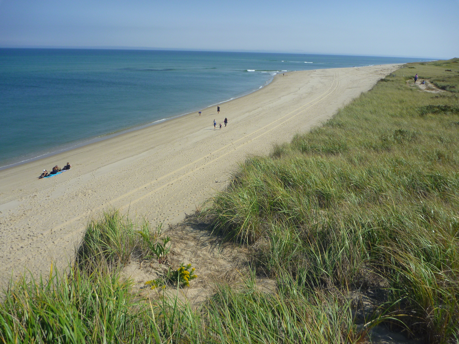
Sand dune landscape of Province Lands with green islands of shrubs or trees
The northern-end tip of Cape Cod was mostly covered by a mixed forest of beech, maple and oak trees before the first European colonists started clearing parts of it for planting and grazing. Today's bicycle trails north of Provincetown provide easy access for bicyclists and day-hikers to explore the remaining forest, access fresh-water ponds and enjoy the magnificient sand-dune landscape with cross-dune views of the Atlantic Ocean.  

Province Lands loop trail map
According to an informational board at the Province Lands Visitor Center, the tip of Cape Cod formed about 4000 years ago. The rest of the cape had already been shaped by glaciers. With global temperature increase, the sea level was rising. Currents carried sand from other sites, deposited it northwest of the precursor tip and formed the sandy Province Lands, which became stabilized and were kept in place by soil formation and pioneer vegetation growing into mature forests. The “Islands in the Sand” quote further below describes this process in more detail.

In this post, I am following the paved loop counter-clockwise, starting at the beech forest parking area on the left side of Race Point Road north of Highway 6 to Herring Cove Beach. Alongside the trail, you will find various interpretive panels featuring interesting subjects of local interest and beyond.

The first 1.8 miles next to Race Point Road wind through mostly open pine forest and over sandy hill sides toward the Province Lands Visitor Center. On a hill top with amazing views, a panel explains, how this land—used over thousands of years by the Pamet branch of the Wampanoag people for hunting, fishing and harvesting wild fruit—became Province Lands:
Just 20 years after the creation of the Boston Common, Plymouth Colony set aside the tip of Cape Cod in 1654 as our nation's second-oldest common land. Eventually called the Province Lands, the area provided resources, like timber and fish, critical to the colony's survival. 
 
Continuing downhill, you will soon arrive at the amphit theater and visitor center within the sand-dune landscape. The sand surface pattern of higher and lower elevations continues beyond the shoreline, where sandbars are a common features. A Cape Cod National Seashore panel at the visitor center points out:
When a ship got too close to land and struck a sandbar, there was no escaping the elements. Fierce winds and powerful waves could break up a wooden ship in minutes.

Cape Tip, Province Lands, Massachusetts
View from the visitor center deck
Westward from the visitor center, the trail soon crosses Race Point Road, where you will find yourself at be a trail junction. Unless your plan is to side-travel to Race Point Beach or to the Race Point Light Historical Site, turn left. It takes about half a mile to get to the underpass leading south of Province Lands Road. Then the trail roughly parallels this road in south-southwest direction to another junction, from where the right-turn trail takes you to Herring Cove Beach. The loop trail continues on the left in eastward direction.

Islands in the Sand

In my opinion, this is the highlight section of the loop. The trail leads to the top of a sand hill, where a panel introduces “Life in the Dunes” and “Islands in the Sand”:

As you look around the dunes you will see “islands” of vegetation. These plants are the result of a long process of soil-building, which starts when a combination of minerals, green algae, bacteria, and fungi form form a crust on the sand, drawing nutrients from the air and water. Lichens, which consist of algae and fungi, also coat the dunes. When these organisms die and decay, they contribute organic matter to the sand beneath them, and prevent the evaporation of water, thus forming soil. As soil builds up, grasses, shrubs, and even small trees, such as bear oak and black cherry can take root. As this process of succession—the change in vegetation species structure—continues, more areas of the dunes become forested.
Trail entering dense forest


The loop trail continues downhill and soon enters the forested lands. This beautiful, shady section of the loop trail leads back to our starting point through dense forest. Sand dune views are gone. Occasionally, you will find a narrow spot from where a fresh-water pond can be approached to scan water lily bloom or search for rare golden club plants.

Province Lands fresh-water pond
Fresh-water pond seen through opening forest greens


Wednesday, July 29, 2020

Merrimack River Walk to Cashman Park and tidal river/salt marsh outlook

Merrimack River boardwalk near the Clipper City Rail Trail


Arriving at the the Merrimack River (also written Merrimac River) by traveling the 1.1-mile-long Clipper City Rail Trail (CCRT) from Newburyport's MBTA station to the “G-Swirl overlook,” you may want to continue trailing around by either turning right to the Waterfront Promenade and Harbor Walk trail leading to the CCRT's other half by turning left toward Cashman Park.

Cashman Park
Cashman Park with Merrimack River


The short waterfront trail to Cashman Park passes a Sportfishing Pier and various boat ramps. The trail continues to a round platform offering an overlook of parts of the tidal Merrimack River and salt marshes.

An informational panel on the platform lists the Bald Eagle, the Salt Marsh Sparrow, the Atlantic Sturgeon, the Shortnose Sturgeon and the Atlantic Bass as species that come here as visitors or for breeding. The tidal river section contains vital salt marsh ecosystems. The panel has the following details:

The Merrimack River also contains other dynamic natural habitats such as Black Oak and Scarlet Oak Woodlands, Brackish Tidal Marshes, Salt Marshes, and Seagrass communities. These tidal creeks, estuaries and salt marshes are highly productive natural resources that provide crititical habitat for many species of birds, fish, reptiles and mammals.


Overlook platform with interpretive panel
Merrickmack River and inner harbor overlook
 

Wednesday, July 22, 2020

Clipper City Rail Trail—the other half

Railroad remnant on Clipper City Rail Trail

The Clipper City Rail Trail (CCRT) connects the Newburyport MBTA station with the historic downtown of Newburyport and the harbor area. There is another CCRT half: its trailhead is located about 2000 ft east of the train station on Parker Street. From the CCRT trailhead arch at the MBTA station go east on Parker Street. After managing the Highway 1 traffic circle, continue east on Parker Street and find the CCRT trailhead on the left—just past the cemetery.
Railroad blocks next to Clipper City Rail Trail

Like the already highlighted first half, this CCRT section features nature, art and history alongside the paved trail. About one third of it is a greenbelt trail, the following third leads through neighborhoods and the final third is an open-air art gallery with paintings of local sceneries.

The following pictures showcase sites and art between you can find between Parker Street and Water Street, where the CCRT turns into the Newburyport Harborwalk trail.


Crab sculpture at High Street underpass

“Dog on bicycle” riding in a CCRT neighborhood garden

“Cat on bicycle” riding in a CCRT neighborhood garden

The art walk passage

“Swallows Over Plum Island” by Leah Grimaldi

“Men Clamming, Plum Island Basin” by Christine Bobek

“Yellow House, Water Street” by Cynthia Kowal

“Green Dory” by Marjet Lesk

“Bartlett Mall: A Hide and Seek Adventure” by Jason Harris

“Old South Church” by Susan Orfant

“Foggy Evening on the River” by Wenda Chelter

“Sunset at Joppa Flats” by Stephanie Noah

“Cross Farm Hill, Plum Island” by Skip Motes

“Boston & Maineat Water Street Crossing” by Alan Bull


“Dream” sculpture near CRRT/Water Street junction

Joggers on CCRT approaching Harborwalk trail


Note: All pictures were taken in mid-July, 2020.