Friday, August 27, 2021

Ipswich open space: Nichols Field

Deer watching at Nichols Field
Nichols Field is a nature reserve located southwest from the point where the Labor In Vain Creek meets the Ipswich River

Butter-and-eggs flowers of the snapdragon family (native to Europe and Asia, introduced to North America)

Forest alongside Ipswich River

A loop trail, less than a half mile long, allows for a gentle hike around open grassland. Alongside the Ipswich River, you will find a stretch of forest. A short spur trail leads down to the shoreline of the Ipswich River and the Labor In Vain Creek.  Here, you can watch the river and marshland scenery with its boat traffic between Ipswich and Little Neck.  

Mud and marsh where the Labor in Vain Creek meets the Ipswich River

Near the trailhead, you will find a bronze plaque on a granite block that honors Ipswich resident Robert K. Weatherall, who volunteered for more than a decade as a Nichols Field land steward. 

Non-motorized and motorized traffic on Ipswich River seen from the forested river bank at Nichols Field


Address and map 

Nichols Field trailhead: 60 Labor in Vain Road, Ipswich, Essex County, Massachusetts 01938.

Map: https://ipswich.files.wordpress.com/2020/03/nichols-field-trail-map.pdf.


Grassy section of the Nichols Field loop trail


References and more to explore

Nichols Field - Ipswich - MA. Massachusetts Trails. URL: https://www.mass-trails.org/towns/Ipswich/nicholsfield.html.

Open Space. Historic Ipswich. On the Massachusetts North Shore. URL: https://historicipswich.org/ipswich-open-space/

Robert K. Weatherall Honored. Ipswich Massachusetts Bridging History. URL: https://www.ipswichma.gov/368/Robert-K-Weatherall-Honored.


Sunday, August 22, 2021

Osprey Overlook Park: Weymouth Back River salt marshes with nesting poles

Upper tidal marsh with nesting pole seen from the Osprey Overlook just south of the Great Esker Park
The osprey is found in a wide variety of habitats—as long as the habitat is situated near a body of water. The coastal brackish waters of the Weymouth Back River southeast of Boston in Massachusetts are such a place. This habitat provides the favorite diet of the piscivorous bird: fish, herring in particular. The man-made nesting poles therein attract osprey pairs to come for breeding in spring and stay over the summer to raise their chicks.

Osprey nesting pole
The Osprey Overlook Park is part of the Back River parklands, which include the Great Esker Park north of the overlook. The loop trail around the overlook hill takes you close to the upper tidal marshes and river banks. Standing on top of the hill allows a survey of the salt marsh scenery around the confluence point of the Fresh River and the Mill River. Two osprey nesting towers can clearly be spotted. When I was visiting in early August 2021, both nests were occupied. One osprey was circling above the overlook area—its white underparts with patterns of brown streaks nicely visible.  

The overlook site features an informative panel touching on various aspect of Back River osprey life. Extractions of the panel text are given in the following.   


About habitat and diet:

Osprey are often found near water bodies as their diet consists almost exclusively of live fish (99 percent). The Back River is particularly productive for osprey due to its strong herring run—one of the few sources of food for osprey in the early spring. In fact, a healthy osprey population is considered a strong indicator of healthy, productive fisheries, which in turn mean productive estuaries and bay waters.


About tree-nesting:

Like many Massachusetts bird species, osprey are tree-nesters meaning they build and spend their resting time in nests high above the ground, often over water. Their conspicuous stick nests are often constructed atop dead trees, channel markers, cell or radio towers, and even utility poles. In effort to attract nesting pairs to the Back River, several manmade towers have been maintained in the salt marshes since the 1990s, providing safe places for the birds to raise newborn chicks.


About mating and migration:

Osprey mate for life and will return to their nesting sites year after year. Typically they arrive in Massachusetts in late March or early April. The males gather sticks and other materials (grass or seaweed, for example) to construct the nests while the females complete the actual construction. A nest can be as large as four feet across and three feet deep. Hatching typically occurs in late May or early June. Come September, the birds leave Massachusetts to migrate as far south as Brazil, spending their winters in South America. Osprey make this trip in about two to three weeks.


Getting there

The entrance of the Osprey Overlook Park is located at the end of Wharf Street in Weymouth, Massachusetts. It can also be accessed from the north via the Back River Trail through abutting Great Esker Park.


Kajakers visiting the Osprey Overlook area


More to explore

Osprey Overlook Park. North and South Rivers Watershed Association. URL: https://www.nsrwa.org/listing/osprey-overlook-park/.

Osprey Overlook and Great Esker Park. The Wine-Dark Sea, May 5, 2020. URL: https://www.thewinedarksea.com/2020/05/05/osprey-overlook-and-great-esker-park/.

Saturday, August 14, 2021

Weymouth's Hidden Gem: Great Esker Park

Whale Island seen from Reversing Falls site in Great Esker Park
The Great Esker Park is owned by the City of Weymouth, Norfolk County, Massachusetts. The park with over six miles of trails is open to the public.

Back River Trail: Great Esker hiking
The park is located on the east side of the Weymouth Back River. It is named after a geological formation known as an esker, referring to a long ridge of stratified sand and gravel formed in a formerly glaciated region. A ninety-feet-high ridge in the park is said to be the highest esker in North America.

South end of Great Esker
The paved Back River Trail passes through the park. Within the park, it follows the esker ridge. An informative trail-side panel with the title “Weymouth's Hidden Gem” explains:

Great Esker Park contains 237 acres of uniquely preserved forest and saltmarsh habitat, featuring the longest wooded shoreline in Boston Harbor and a unique geological landmark known as an esker.

The narrative on the panel also celebrates Mary F. Toomey, who strongly advocated to preserve this precious esker and saltmarsh land:

Great Esker Park was acquired by the Town of Weymouth in 1965 through the National Park Service's Federal Lands to Parks Program thanks in part to strong advocacy from local environmentalist Mary F. Toomey. Prior to this the land had been owned by the navy dating back to 1912 and was part of the munitions depot in Hingham. Shortly after, Mart founded the Great Esker Park Natural Science Center in 1966 and would continue to advocate for the Back River throughout her life. She was instrumental in the creation of multiple parks along the river and established the Back River watershed association in 2000. In 1991 she received an Environmental Merit Award from the EPA and in 2004 she received the Gulf of Maine Times' Visionary award for her work.

The Field Guide to New England describes an esker as “a long, sinuous ridge composed of sand and gravel deposited by meltwater streams flowing in tunnels along the bottom of a melting glacier” and further says “Eskers stand as much as 50 feet above the surrounding landscape” [page 21 in the Field Guide by Peter Alden and others, National Audubon Society, Alfred A. Knopf, New York, Fifteenth Printing, March 2020].

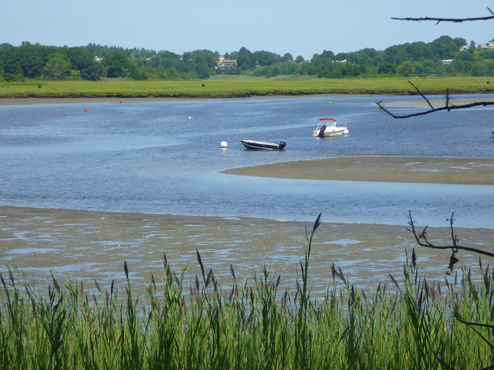
Up to 90 feet high, the Weymouth esker is literally an outstanding feature. Various unpaved trails connect the Back River Trail over the high esker with lower esker sections. Forest trails, riverside trails and “saltmarsh beaches” invite for canoe, kayak and wildlife watching. Several saltwater inlets/outlets can safely be crossed during low tide. At the “Reversing Falls” post a path veers off the Back River Trail, leading eastward to the Weymouth Back River area with Whale Island and the Reversing Falls. When the tide is going out, the water from the esker-surrounded Reversing Falls Marsh flows east. When the tide is coming in, the water flows in reverse direction into the marsh.


Reversing Falls Marsh
 
Trail along an esker ridge


Getting there

The Great Esker Park has various points of entry. The north gate parking area is found just off Highway 3A (Bridge St, Weymouth, MA 02191); south of Abigail Adams State Park.


Map showing trails around the Reversing Falls Marsh


More to explore

Great Esker Park - Weymouth - MA. URL: https://www.mass-trails.org/towns/Weymouth/greateskerpark.html.  

Great Esker Park in Wymouth. Boston Geology. URL: https://bostongeology.com/geology/fieldtrips/trips/weymouth/esker.htm.

Hiking Trails of Weymouth. Great Esker Park. South Shore Hiking Trails. URL: https://www.south-shore-hiking-trails.com/great-esker-park.html.

Bare Cove / Great Esker, Hingham. NEMBA. URL: https://www.nemba.org/trails/massachusetts/bare-cove-great-esker-hingham. Map for download: https://www.nemba.org/sites/default/files/GreatEskerBareCove_Sep_2014.pdf.

Back River Trail. North and South Rivers Watershed Association. URL: https://www.nsrwa.org/listing/back-river-trail/.

Reineck, H.-E. und Singh, I. B.: Depositional Sedimentary Environments. Springer-Verlag, Berlin, Heidelberg, New York, 1980, ISBN 0-387-10189-6.


Wednesday, August 4, 2021

Outer Boston Harbor: scenic Georges Island

Fort Warren on Georges Island, Massachusetts: sally port leading into the pentagonal fort

Seven miles offshore from downtown Boston, Georges Island is where you want to be on a clear, sunny day to explore the Boston Harbor island scenery. The landscape of Georges Island is defined by the historic granite structures of Fort Warren. Walk along its ramparts to view the surroundings: Boston Light on Little Brewster Island to the east, the city skyline to the west, and nearby Lovells Islands to the north across The Narrows—the only deep-water channel that leads to the inner harbor. The island's strategic location for defending the Boston area, during times when the enemy—including pirates—was only expected by sea, becomes obvious.  

Fort Warren is named to honor 18th century physician, soldier and Revolutionary War hero Joseph Warren (1741-1775), who died at the Battle of Bunker Hill, Massachusetts. Ranger-guided tours of the fort are provided. The visitor center has detailed information available and interesting exhibits at display. If you plan to explore sites on your own, you will appreciate informative plaques at various sites. The following picture tour is supplemented by texts as given on selected plaques. 

Georges Island Visitor Center at the ferry landing site

View from east-side rampart: sally port and Boston skyline
Walking through the sally port into the pentagonal fort with its arrowhead-shaped corners, first-time visitors are impressed by the grassy parade ground:

From the beginning, Fort Warren's heart was the six-acre parade ground. When the Civil War broke out soon after the fort was completed, the area was still covered in construction debris. Newly enlisted Massachusetts regiments cleaned it up as they trained. To increase morale, they sang as they worked, eventually coming up with the famous lyric for “John Brown's Body.” Since that time the parade ground has been used for drills, inspection, parades and calisthenics, as well as off-duty sports such as baseball and football. The oldest maples and horse chestnuts on the perimeter date back to the 1880s.

Grassy parade ground inside Fort Warren with powder magazin

The northeast corner of the fort is Bastion C, which retains its original form and protective outworks. Here, the mess halls and the fort bakery were located:

The rank and financial status of Ft. Warren residents determined the quality of meals they ate. Rations for Union soldiers consisted of fresh beef with potatoes three times a week, salt beef, pork or ham three times a week, and baked beans on Sunday. Confederate soldier prisoners ate the same rations, but cooked their meals in large pots outside their rooms instead of eating in the mess halls. Southern political prisoners and officers who could afford it made outside arrangements with Boston caterers. The “North Carolina Mess,”composed of prisoners from Cape Hatteras, purchased extras such as cheese and crackers, sausages and cakes for 16¢ (unicode:¢)  a day.

Historic Fort Warren bakery
Across the bakery, you will find one of many stairways that allow you to walk up to the ramparts:

This spiral granite staircase leads to the ramparts level above and to an observation tower built during the Spanish-American War. In addition to providing a higher vantage point, the ramparts supported heavy artillery which were mounted on semi-circular tracks called traverses. During the Civil War, a walk on the ramparts was a welcome relief for the Confederate prisoners. Writing of an excursion by steamboat to Ft. Warren in 1872, the American novelist William Dean Howells recalled “the green thick turf covering the escarpments, the great guns loafing on the crest of the ramparts, and the sentries pacing up and down with their gleaming muskets.”


Rampart with semi-circular tracks on which artillery was mounted

Stairs connecting west-side rampart with powder magazine
Walking around the ramparts, you may have noticed the building on the parade ground. This is a  powder magazine:

There were nine magazines within the fort's bastions and fronts during the Civil War, all of them located at the parade ground level. They were lined with wood to prevent a soldier's gun or belt buckle from striking against the granite walls and causing a spark, which could set off an explosion of the volatile black powder. This large magazine for the storage of bulk ordnance supplies was part of an 1869 modernization plan. Its isolated location, heavy construction and surrounding wall reflect further efforts to protect the garrison from chance explosion. Additional magazines were built at the same time on top of the coverface close to the long-range artillery. 


Powder Magazine

Wall building with rampart, cannon and parapet on its roof


Getting to Georges Island

Over the summer season, Georges Island services are offered from Boston Harbor (Long Wharf) and Hingham: https://www.bostonharborislands.org/ferryschedule2021/.


Map of Georges Island


References and more to explore

Georges Island. National Park Service. URL: https://www.nps.gov/places/georges-island.htm.

Georges Island/Fort Warren. The Cultural Landscape Foundation. URL: https://tclf.org/georges-island-fort-warren.

A view of the single drumlin that makes up Georges Island. Picture in https://bostongeology.com/boston/geology/islands/islands.htm.