|
| Western Greenway Trail in the Chester Brook Corridor |
The Western Greenway Trail is a recreational, mostly single-track trail snaking through a green necklace with multiple access points at neighborhoods in Waltham, Lexington and Belmont, Middlesex County—northwest from downtown Boston. The roughly eight-mile-long trail offers mountain bikers, runners and hikers a variety of paths through forests and across bogland.

I went on a hike from Waltham to Belmont along the Greenway Trail on November 20, 2021, by starting at the Waltham commuter rail station and calling the hike done at the Waverley station. Both stations are on the MBTA Fitchburg Line and are served every two hours on week-end days with a train arriving from and going to Boston's North Station.
From the Waltham station, I walked north on Elm St, Church St and Lyman St to get to the Meeting House Walkway next to Beaver Street. Close to Forest Street, the Western Greenway Trail ascends on the left side off the Meeting House Walkway. After about ten minutes I arrived at the landmark Stonehurst country house, a “must-see” historic landmark of the Robert Treat Paine Estate. According to an onsite panel, “Stonehurst is an icon of American design created by architect Henry Hobson Richardson and landscape architect Frederick Law Olmsted.” The grandeur of this place—including the country house, an open, smoothly undulating hillside and a glacier rock with amazing views—attracts many visitors.
 |
| Historic Stonehurst country house, seen from Glacier Rock |
Continuing north on the Greenway Trail, I came to another panel listing native trees found at the estate: red maple, sugar maple, red oak, white oak, eastern white pine and Canadian hemlock. From this point onward, most trail users were mountain bikers. What follows are selected snapshots along and off the Greenway Trail.
 |
| A part of Lexington's West Meadow, a large “quaking bog,” seen from the boardwalk |
 |
| Greenway trail bridge over Beaver Creek connecting Waltham (left side) with the Rock Meadow in Belmont |
 |
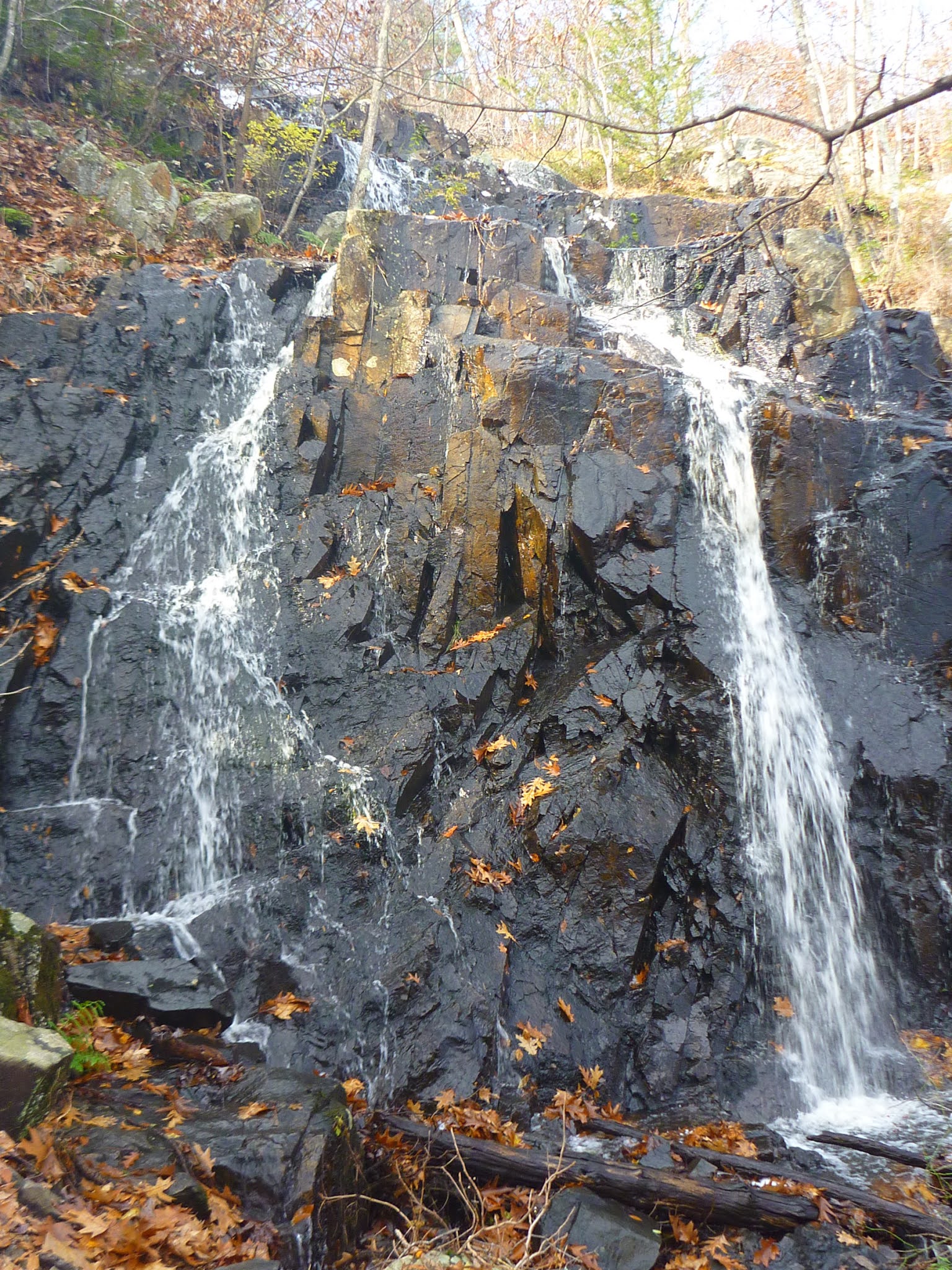
| Rock Meadow near Beaver Brook |
 |
| Pine Allee |
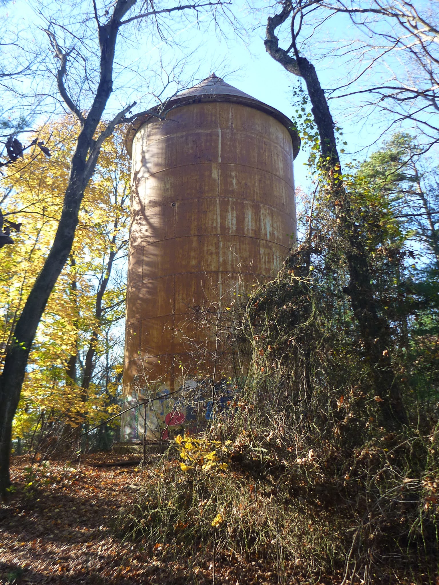 |
| Water tower between Pine Allee and McLean Woods |
Maps of the Waltham-Lexington-Belmont green necklace
In the following, I have listed URLs for the trail section maps and included some keywords of what you can find in each map, i.e. what you may want to see while traveling the Western Greenway Trail through the green necklace and exploring it sideways.
“Storer Conservation Land Trails” Map
Western Greenway trailhead at Meeting House Walkway parallel to Beaver Street, Stonehurst (Paine Estate), Chester Brook Woods. URL: https://walthamlandtrust.org/wp-content/uploads/2017/03/2016-11-12-GOS-Storer-Conservation-Trails-Rotated.pdf.
“Chester Brook Corridor” Map
YMCA Land and Shady's Pond Conservation Area. URL: https://walthamlandtrust.org/wp-content/uploads/2017/03/2016-08-19-GOS-Chesterbrook-Corridor-Rotated.pdf.
“Middlesex County Hospital Lands” Map
Falzone Park (Waltham) and Water Tower (Lexington). URL: https://walthamlandtrust.org/wp-content/uploads/2017/02/2016-08-19-GOS-Middlesex-County-Hospital.pdf.
“Beaver Brook North Reservation” Map
Long boardwalk across bog (with bog-watching benches) west of the “Avalon at Lexington Hills” complex and Beaver Brook North Reservation. URL: https://walthamlandtrust.org/wp-content/uploads/2017/07/2017-07-29-GOS-Beaver-Brook-North-Reservation.pdf.
“Rock Meadow” Map
Wetland, Twin Oaks, bee hives. URL: https://www.massaudubon.org/content/download/19735/276592/file/WG_Rock-Meadow-Trail-Map.pdf.
“Lone Tree Hill” Map
Pitch Pine Woodland, Pine Allee, Red Maple Swamp, Water Tower, Eastern Woods, McLean Woods. Eastside trailhead (ten minutes away from Waverley train station): continue southwest on Pleasant St, turn left on Trapelo Road, which bridges the railroad tracks at the station. URL: https://www.belmont-ma.gov/sites/g/files/vyhlif6831/f/file/file/lone_tree_hill_trail_map.pdf.