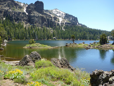
Castle Peak of the northern Sierra Nevada, with an elevation of just above 9100 feet (2770 meters) [1,2], is visible from several scenic hiking and mountain biking trails around Truckee, such as the Mt. Judah Loop Trail (from where Castle Peak is viewed in the picture below) or Sawtooth Trail vista points along the Truckee River canyon. The most characteristic features of the Castle Peak ridge include its south-facing range of cliffs and the ramparts and turrets on its top [3,4]. Turret (from Latin turris) literally means a little tower projecting skyward from a wall. Yet, this “castle complex” is not a medieval fortification or surveillance architecture, but a leftover from ancient volcanic activity that shaped the Sierra Nevada and Carson ranges with Lake Tahoe in between—about 5 to 25 million years ago [5].

The top picture shows the dominant easternmost castle—the highest peak. Originally, Castle Peak was named in 1896 in recognition of Stanford University: Professor Bolton C. Brown named it Mount Stanford. But the Sierra's Placer County had already a mountain with this name and it eventually was changed to Castle Peak [6].
On clear days a 360-degree view can be enjoyed, including volcanic Lassen Peak in the north, the coastal ranges in the west, the Carson Range in the east and the granite-based Desolation Wilderness in the south.
Getting to the Castle Peak summit
Since the Castle Peak Trail is part of a growing trail network of the Tahoe National Forest in California's Nevada County north of Truckee and Donner Lake, summiteers have many options to plan a hike that includes the ridge and summit of Castle Peak. One of the shorter versions is a hike beginning at the short dead-end road just north of the Castle Peak/Boreal Ridge Road Interstate-80 exit west of the Donner Summit rest stop. From there, a dirt-road trail through Castle Valley's pine and fir forest and along green meadows leads to the junction with a popular biking trail named Hole in the Ground Trail, which connects the Castle Peak foreground with the Lola Montez Lakes. Continue on the gravel path, with views of the “castle” to your right, until you get to the marked junction with the Pacific Crest Trail (PCT). Climb up the short PCT section to Castle Pass. There, leave the PCT by turning right onto Castle Peak Trail. Follow this scenic trail ascending to the top ridge and castle turrets. Parts of this trail are steep with loose gravel.
In case you don't want to take the same trail back, you may want to continue east to the Frog Lake Overlook and then descend southward towards Donner Summit and the PCT junction.
References and more to explore
[1] Peakbagger: Castle Peak, California [www.peakbagger.com/peak.aspx?pid=2551].
[2] Don's Notes: Tahoe-Donner/Sod Springs Area Map with Castle Peak, Andesite Peak and Lola Montez Lakes [donsnotes.com/tahoe/i80-sp.html].
[3] Sierra Nevada Geotourism MapGuide: Castle Peak Area Trails [www.sierranevadageotourism.org/content/castle-peak-area-trails/sie877D22DB40BAD902B].
[4] Summit post: Castle Peak [www.summitpost.org/castle-peak/152352].
[5] Don's Notes: Geology of Lake Tahoe and the Sierra Nevada [donsnotes.com/tahoe/geology.html].
[6] Barbara Lekish: Tahoe Place Names. Great West Books, 1988; Stanford.


