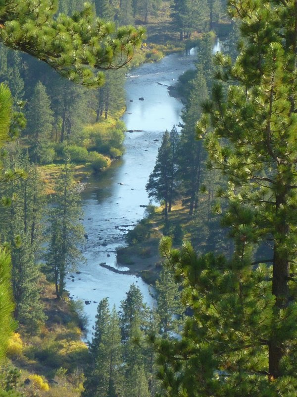
 The Sawtooth Trail is located in the Tahoe National Forest south of Truckee in California. I am not sure if the trail is named after the many U-curves along its path or after some of the tooth-shaped rocks at the edge of the Truckee River canyon. Anyway, there are nice views from the canyon edge of the trail. Other sections of the trail loop through Jeffrey pine and white fir forest and manzanita areas. Mountain bikers love the curvy nature of the trail.
Getting to the trailheads
From the intersection of Donner Pass Road and Bridge Street in downtown Truckee, drive south on Bridge, cross the railroad track and continue until the road bends eastward and continues as Brockway Road. Turn right at Palisades Drive, which continues as Ponderosa Drive by making a slight left turn. Pass Pine Cove Road to your right and then take Silverfir Drive. Go west for less than half a mile and turn left at Thelin Drive. After 0.1 mile take 06 Fire Road on the right, pass the steel gate and drive to the beginning of the dirt road, where you'll see the first parking area and trailhead. There are other Sawtooth Trail access points further south, which you can reach by car if you follow the dirt road. The trail itself is a well-marked single-track trail.
Maps and trail review
[1] Map with Truckee dirt trails: http://www.truckeetrails.org/trails.php?TrailID=11&type=Dirt.
[2] Sawtooth trail: http://www.yelp.com/biz/sawtooth-trail-truckee.


No comments:
Post a Comment