Saturday, August 20, 2016

Getting started with Lava Beds caves

Daylight flooding into Skull Cave
Lava Beds National Monument, dubbed the land of burnt out fires, has over 700 caves. Lava Beds park is a high desert wilderness. It can get very hot here in summer. You want to take cool dip? You can have it right here. The air temperature in the caves is about 55 °F (13 °C) year-round and the temperature in ice caves is even lower. There are caves to be entered via staircase or ladder. Each step downcave increases the physical chill. The handrails almost turn icy. Then, climbing up and out may give you some sort of a heat shock.

Mossy rocks at Mushpot entrance
A nice cave to start your hot-cold experience is the Mushpot. This 770-foot-long underground tube is only a 524-foot-walk away from the visitor center—where you should stop first to get informed about the diverse caves in the park and their various levels of challenge. The Mushpot has a relatively smooth, paved path. If you are tall, be prepared to duck-walk in some places. A hard hat may protect your head, but also makes you taller. While stepping down into the Mushpot hole you will notice the spongy and soft moss covering the surface of the upper-cave twilight zone. Inside the lava tube, you will walk along a lighted path guiding you through and back between narrowing walls and interesting formations—assisted spelunking. 

Don't expect other caves to be illuminated. Bring good flashlights. Skull Cave (2.4 miles from the visitor center) has a relatively large entrance. Daylight “lasts” for a while along the downhill path past its opening mouth (see top picture), but you need artificial lighting towards the tube's end to explore the ice floor. The cave is named for bones found inside: two human skeletons, bighorn sheep skulls and bones of antelope and mountain goats.

Staircase into Merrill Cave
Another cave with an ice floor is Merrill Cave (2.8 miles from the visitor center). Rather than being a cave of the dead, this ice cave has seen lively entertainment. Visitors in the early 1920s skated on its ice floor by lantern light. Today, global warming is dimming the chances of cave ice parties in the future. We learn this, while we come to recognize the projection put down on a panel at Merrill Cave's entrance:  

In 2000, Merrill Cave's massive, thick “ice rink”  began to rapidly melt. The more ice melts, the warmer the cave becomes. Consistently cold winters, along with rain and melted snow dripping from above, are necessary to sustain ice throughout the year. Though natural shifts in conditions play a role, you can now see the effects of global climate change in ice caves at Lava Beds. Average annual surface temperatures have risen about two degrees over the last six decades, while average precipitation levels have fluctuated greatly. These factors have contributed to a dramatic loss of ice in the majority of monitored caves. If trends continue, could the ice caves at Lava Beds someday lose all their ice? 
 
Global climate change can be monitored right here at Lave Beds. Or is it only a limited microclimate change in a remote area of northeast California?

References and more to explore
[1] National Park Service: Lava Beds Caves [www.nps.gov/labe/planyourvisit/upload./LAVA%20BEDS%20CAVES.pdf].
[2] The Path Less Beaten: Lava Beds National Monument  [thepathlessbeaten.com/2012/08/09/lava-beds-national-monument].
[3] Edward Brook, Lacey Little and Shane Fryer: A Preliminary Investigation of Cave Ice at Lava Beds National Monument, norther California [depts.washington.edu/pnwcesu/reports/J8W07100050_Final_Report.pdf].
Thursday, August 4, 2016

The land of burnt-out fires

Red-colored rock “glowing” before sunset at the fractured rim of Black Crater in Lava Beds National Monument park

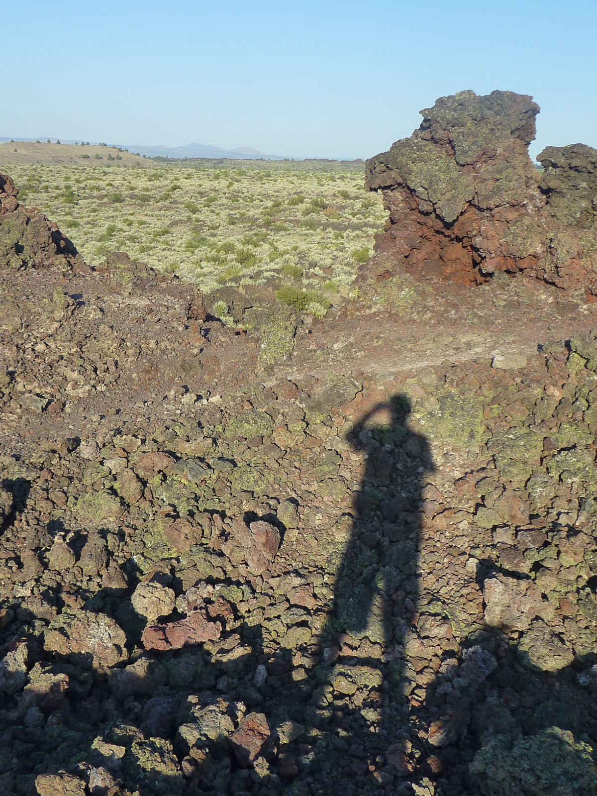
The land of burnt-out fires is an area of northeast California that formed long ago, when flowing lava from volcanic eruptions cooled and shaped the landscape. Today, this is Lava Beds National Monument—a park of lava blankets, caves, catacombs, cones, chimneys and craters.

According to the park service hand-out, there is evidence of over 30 separate lava flows throughout the park. Multiple eruptions from volcanoes and surface vents created the current structure of holes, tubes, caves and underground labyrinths. The hand-out informs:

Eruptions occurring 30-40,000 years ago formed over 700 lava tube caves found in the park. Lava tubes form when streams of hot, flowing lava start to cool. The center of the stream stays hot and continues to flow as the outside begins to cool and harden. The hot lava drains out, leaving a pipe-like cave. Multiple eruptions can stack caves on top of one another, creating multilevel caves. When a lava tube ceiling collapses, it opens access to the cave below.

Entrance of Skull Cave, 2.4 miles north of the visitor center
Visitors to Lava Beds typically explore the park underground and between the rocks on its surface. Some of the 700 caves have inspiring names. Skull Cave with its wide and open entrance, for example, is named for the two human skeletons and bones of pronghorn, bighorn and sheep discovered inside. A special caving hand-out lists selected caves, classified as least challenging, moderately challenging and most challenging. In some caves you can walk completely upright, in others you may have to duck-walk or crawl in some places. Certain caves feature stairs you can use to step down and in. The cave or tube length varies from 150 to 7000 feet. The generally given advice: Cave softly and safely!  

Above ground, you will find short-and-easy as well as long-distance hiking trails leading to caves and other points of interest. The 9.4-mile-long Lyon Trail connects the Skull Cave area with Hospital Rock near Tule Lake Sump. The 7.5-mile-long Three Sisters Trail connects the Indian Well Campground near the visitor center with the Lyons Trail and provides for a loop hike of about eleven miles by including a section of the Bunchgrass Trail and the Missing Link Trail. The 3.3-mile-long (one-way) Whitney Butte Trail leads from the Merrill Ice Cave parking lots to Whitney Butte. A 1.2-mile-long (one way) trail from the Black Crater parking site provides access to the historic Thomas-Wright Battlefield between Hardin Butte and Black Crater.

The descriptive term “land of burnt-out fires” is derived from what the Modoc people called the lava-bed lands in their language. A perfect name—over 30,000 years of volcanic history compacted into a few words.The Modoc and their ancestors lived here for over 10,000 years. Some ancestor generations must have witnessed volcanic events; for example, the giant explosion further north that turned Mt. Mazama into Crater Lake. Or volcanic activity to the southwest including eruptions of the nearby Medicine Lake Volcano or in the Lassen Volcanic area. The ragged and rough terrain of the lava beds was, to generations of Modoc, a sacred landscape and a resourceful homeland.

Nature's glass: obsidian
Obsidian—nature's glass—shown along the path from the visitor center to the Mushpot cave

Thursday, July 21, 2016

Sunset Beach Trail

The mouth of Drakes Estero with the tip of the Pastoral Lands in the background
Sunsets are a common theme among visitors to the Californian coast. The Sunset Trail on Angel Island, for example, offers great views of the Golden Gate—and chances of a golden sunset to be watched after the last ferry for the day has left. Further north at Point Reyes there is a Sunset Beach Trail. This dead-end trail through grassland to rocky Sunset Beach west of Drakes Head follows the coastline of Drakes Estero. South of Sunset Beach Drakes Estero joins Estero de Limantour. Together these two marshy estuaries meet Drakes Bay.

Coastal gum plant next to Sunset Beach Trail
You will start out on Estero Trail, which traverses a pine forest, crosses Home Bay along a narrow isthmus and then leads southwest, up and down over undulations. Once you are getting to the junction where a trail leads eastward over the Drakes Headland, you will have arrived at the beginning of Sunset Beach Trail, which continues above Drakes Estero's eastern shores. While scanning the bay for marine mammals and seabirds, also watch out for deer and free range cattle.

Home Bay crabs: becoming bat ray diet at high tide?
The Estero Trailhead kiosk informs visitors that bat rays are common in Drakes Estero, which—along with Tomales Bays and Bolinas Bay—serve as nursery and feeding spots. Maybe you have noticed some crabs crawling around while walking along the Home Bay isthmus. These crabs are part of the bat ray diet. But the bat rays forage on other invertebates as well. Most of the muddy bottom of Home and Estero Bay is exposed to air and to your views at low tide. I am wondering if rays can be spotted with binoculars from Sunset Trail at high tide, when the muddy floor is submerged by enough water to accommodate bat ray movement and their foraging activities?

Sunset Beach Trail coming down to sea level
The final section of Sunset Beach Trail drops toward a coastal lagoon. Across a narrow isthmus, you should be able to see the tip of the Pastoral Lands (top picture) and Chimney Rock further out, unless coastal fog is moving in and between. The intertidal zone at Sunset Beach is teeming with life. Animals typical for such saltwater pool habitats—including sea stars, urchins, barnacles and anemones—can be observed.
Estero Trailhead, Point Reyes, California
Estero Trailhead kiosk
Getting to the Sunset Beach Trail
From the Bear_Valley_Visitor_Center at Point Reyes National Seashore (see park map) head north on Bear Valley Road to its junction with Sir Francis Drake Boulevard (SFD Blvd.). Follow SFD Blvd. to Inverness and continue on. SFD Blvd. eventually turns left (west). Pass its junction with Pierce Point Road and Mount Vision Road. Then turn right where a sign gives direction toward the Estero Trailhead. Find trailhead parking after about one mile.The hiking distance between the trailhead and Sunset Beach is about 4.5 miles. Plan for a round trip of nine or more miles, including estero and beach side steps.

Wednesday, July 20, 2016

A continuous fence split and opened up a 20-feet-wide gap

A fence at right angles to the fault line split by the 1906 rupture of the San Andreas Fault

The lore of the 1906 earthquake that devastated San Francisco spread around the world. Along the 0.6-mile-long Earthquake Trail within the Point Reyes National Seashore park in rural west Marin County, Northern California, you can see a split fence that still provides evidence of the 1906 fault movement.

Alongside the Earthquake Trail, interpretive signs describe the geology and earthquake history of the San Andreas Fault, which separates Point Reyes on the Pacific Plate from the North American plate. Tomales Bay and Olema Valley cut through the landscape of the joining plates. The Earthquake Trail is located in the rift zone between the Bear_Valley_Visitor_Center and Olema. Here, as elsewhere between San Juan Bautista and Cape Mendocino, the rupture of the San Andreas Fault during the Great 1906 San Francisco Earthquake on April 18 left its mark. As an interpretive panel tells you, Point Reyes moved northwest up to twenty feet and the fence split by this distance. Blue posts indicate the active fault trace. 

Another interpretive panel explains that the two plates move, on average, two inches annually. We—and those fences we like to build—are only around for a geologic moment and “if lifetimes were measured in eons rather than years, we would witness tremendous movement and change along the western edge of North America. The San Andreas fault, the boundary between the North American and Pacific plates, is part of a 30 million-year geologic story that is still unfolding. 10 million years from now, the plate boundary will likely shift inland east of the Sierra. The Gulf of California will expand and most of California will be transferred to the Pacific plate.” I guess, Nevada will then be the prime state of ruptures, slips and shakes.   

Getting there (not to Nevada, but to the Point Reyes Earthquake Trail)
Go to the Bear_Valley_Visitor_Center at Point Reyes National Seashore (see park map). Find the picnic area just across the street & parking strip next to the visitor center. The Earthquake Trail loops through the fault zone east of the picnic site. It takes less than half a mile to get to the split fence. And even if earthquake history does not belong to your main interest, this short and scenic loop trail is worth a walk. Looking for another short trail nearby? What about the Kule Loklo Trail northwest of the visitor center?
Earthquake Trail crossing a creek in Olema Valley

Sunday, July 17, 2016

From Ayala Cove to the top of Mt. Livermore: Sunset Trail

View of the Golden Gate from Mt. Livermore summit

With an elevation of 788 ft (240 m), Mt. Livermore is anything but a tall mountain. Yet, as Angel Island's tallest peak in the middle of San Fracisco Bay—east of Sausalito and north of Alcatraz— the top of Mt. Livermore offers spectacular views of the central bay, surrounding mountain ranges, the Bay Bridge, the Golden Gate Bridge, the Richmond-San Rafael Bridge and the skyline of San Francisco and Oakland.

View points along Sunset Trail
The Sunset Trail begins at its junction with the Perimeter Road near the Visitor Center and Hill Group Picnic Area above Ayala Cove. At first, the trail leads through a hillside forest of non-native eucalyptus tress as well as cypress and pine trees. Once you are arriving at the west-side ridge, the forest opens up. From here, the panoramic view includes Raccoon Strait, Tiburon, Belvedere Island, the Marine Headlands and the Golden Gate. As you continue uphill, more of the skyline of San Francisco will come into view. Once at the summit, your view may start spinning. Relax, take a breath, enjoy and slowly start identifying the places you know or want to go to next.

If your plan is to make the summit trip a loop hike, walk downhill through the chaparral on the east side of Mt. Livermore. The North Ridge Trail will take you back to Ayala Cove. Halfway downhill you will enter a forest of oak, madrone and bay trees—providing some shade, but having enough openings to still get a glimpse of a historic garrison building here or a sailing boat there.

The summit of Mt. Livermore seen from the North Ridge Trail

Angel Island State Park map: scroll down the California State Park hand-out to find an annotated, topographic map of Angel Island showing trails, campsites and points of interest.

References and more to explore
[1] The Outbound Collective: Hike Mt. Livermore [www.theoutbound.com/san-francisco/hiking/hike-mt-livermore].
[2] BAHIKER: Angel Island State Park, California State Parks, Marin County [bahiker.com/northbayhikes/angelisland.html].
[3] SOCALHIKER: Angel Island Mt. Livermore Loop [socalhiker.net/hiking-angel-island-mt-livermore-loop-trail/].

Saturday, July 16, 2016

Angel Island State Park

In the midst of the bustling Bay Area, there is a natural island that, with the exception of service and TramTours vehicles, is free of motorized traffic: Angel Island. The green and hilly island makes for a great escape from the urban surroundings. However, on week-end days the island's coves and trails may turn into recreationally busy sites. The small harbor often bustles with boats and on a clear-view day quiet a crowd may head uphill to enjoy the spectacular bay panorama from the top of Mount Livermore.
Ayala Cove with harbor and a section of the Perimeter Trail above the ferry terminal
Angel Island has many faces and offers a multitude of spectacular vistas, both from its hillsides as well as from the Perimeter Trail. By circumnavigating the island on water or coming across Raccoon Strait, one experiences different currents, wave patterns and microclimates. Ayala Cove on the north side of the island is typically the warmest spot, with the least amount of wind and the lowest chance of fog. Most visitors arrive at the small Ayala Cove terminal by ferry from Tiburon or Fisherman's Wharf in San Francisco. Ayala Cove is named for the Spanish navigator Juan Manuel de Ayala, who—out of New Spain (Mexico)—explored San Francisco Bay in 1775 and then gave Angel Island its name [1]. In missionary Zeitgeist euphory he named it “Nuestra Senora de Los Angeles,” meaning “Our Lady of the Angels” [2]. Not the only Californian place associated with angels, the place name was later shortened to Angel Island.

Segway riders on Perimeter Trail with view of Belvedere Island
Organized rides, Segway tours and bikes for rent are available. But any place on the island can also be reached on foot while getting around on a day hike; or even a half-day hike. Environmental Campsites exist on the west and on the east side. There are various historical landmarks and now-abandoned army places to explore. The newly renovated United States Immigration Station (aka North Garrison), a National Historical Landmark, is open to the public. It only takes a short walk along the Perimeter Trail east of Ayala Cove to get to the immigration station, through which thousands of mostly Asian immigrants were “processed” in the late nineteenth century. On most days, docent-led tours are available to learn more about this site.

An abandoned building next to the Perimeter Trail through Fort McDowell
Head south from the immigration station, to see a ghost army post: Fort McDowell (aka East Garrison). This post served many purposes and became a military embarkment center during World Wars I and II. Japanese and German POWs were held here during the second World War. Just south of Fort McDowell is Quarry Beach, a delightful stretch of sand—a half-mile-long strip of shoreline away from the main visitor routes, great for picnicking, wading and bird watching. Seals are often swimming by and dive close to the beach. 
Quarry Beach on Angel Island, California
Quarry Beach with a ship passing Quarry Point east of Fort McDowell

References and more to read
[1] California Explorers: Juan Manuel de Ayala and San Francisco Bay [factcards.califa.org/exp/ayala.html].
[2] Legends of America: Fort McDowell (Angel Island) [www.legendsofamerica.com/ca-forts4.html].
[3] Angel Island Conservancy: Ft. Mc Dowell (aka East Garrison) [angelisland.org/history/ft-mcdowell-aka-east-garrison].

Sunday, July 10, 2016

Suisun Hill Trail

Suisun Slough labyrinth north of Rush Ranch
Not many people hike Suisun Hill in summer. Although this two-mile-long loop trail is not very challenging, visitors often are satisfied with views of Suisun Slough and surrounding marshlands from overlook hills along Marsh Trail and South Pasture Trail near the barn and visitor center of Rush Ranch. Suisun Hill Trail, however, is the only Rush Ranch trail that allows dogs. And if you and your dog(s) enjoy scanning open-space wetlands, Suisun Hill Trail is a treat all year round.

From the trail gate on Grizzly Island Road, head northeast toward the hill (or should I say hills) and turn left at the trail fork to begin your 500-foot climb. Marsh vistas are coming up soon. Depending on the air quality, you will see Mount Diablo in the south and the range of hills contouring northwest Solano County. The blue and green colors of the low Suisun Slough terrain are nicely contrasting with the straw-yellow hillsides. To complete the loop hike, continue down the other side of Suisun Hill and follow the well-maintained trail, which bends back toward the Rush Ranch entrance on Grizzly Island Road.

Suisun Hill
Suisun Hill Trail through dry grassland toward the top of Suisun Hill


Getting to the Suisun Hill Trailhead
Instead of driving all the way to the barn and visitor center, as described at the end of my ranch site post, park your car at the Rush Ranch entrance (without blocking it); for example, close to the Solano Land Trust gate post. Access the trail by walking across Grizzly Island Road and through the marked gate.