Monday, December 13, 2010

Lichen back from space


These lichen samples were shown to the public at the COSPAR 2010 Meeting (www.cospar2010.org) this summer in Bremen, Germany. The lichen has an interesting history of traveling. In June 2005, it was send into space with BIOPAN (‘biological pan’) mounted externally to a Russian re-entry capsule. BIOPAN is a multi-user facility, which can be opened in space by telecommand to expose biological samples to the “local” conditions.

The lichen samples in the picture were exposed to the full spectrum of solar light including UV, cosmic rays, space vacuum, microgravity and extreme temperatures. Their BIOPAN container was closed and hermetically sealed during re-entry and return to Earth.

The lichens survived their exposure to space conditions during a two-week flight and resumed their metabolism on Earth. Although lichens live and thrive in harsh planetary environments such as desert rocks in Nevada, their space survival is a surprise. In the past, some scientist (and science fiction authors) have argued that lichens and other organisms might arrived on Earth via “space flight.” The current findings give more credit to such possibilities. But what natural system achieves the critical protection for organisms to enter the atmosphere from outer space and reach Earth's surface intact?

Thursday, December 9, 2010

A silvery whale in Bremen


At a hasty glance, this shiny building may be mistaken for a giant whale. Actually, the silvery construction is housing the Universum Science Center Bremen. It was designed by architect Thomas Klumpp. The Universum features a permanent exhibition and frequently adds special exhibitions. The concept is hands-on experiencing of nature and technology.

The Universum is located near the University of Bremen. This area has been a wetland, and still is. Various narrow trails can be found between buildings, ponds, canals, and beer gardens. Small nature preserves, study areas and the city forest (Bremer Stadtwald) are nearby. Students as well as Bremer (city residents) and visitors come her for jogging, biking, swimming, surfing, paddling, rowing, horse riding, kite flying and live music events. This former, frequently flooded lowland has turned into a multiverse—for real.

More on locatation, exhibits and events
Address: Universum Bremen, Wiener Str. 1 a, 28359 Bremen.
Getting there: From the airport or the central station, take light rail No. 6, exit at the “Naturwissenschaften 2” stop and walk (less than 5 min.) to the Wiener Str./Unversitätsallee intersection.
About the Universum: http://universum-bremen.de/en/home/about-us.html.

Wednesday, December 8, 2010

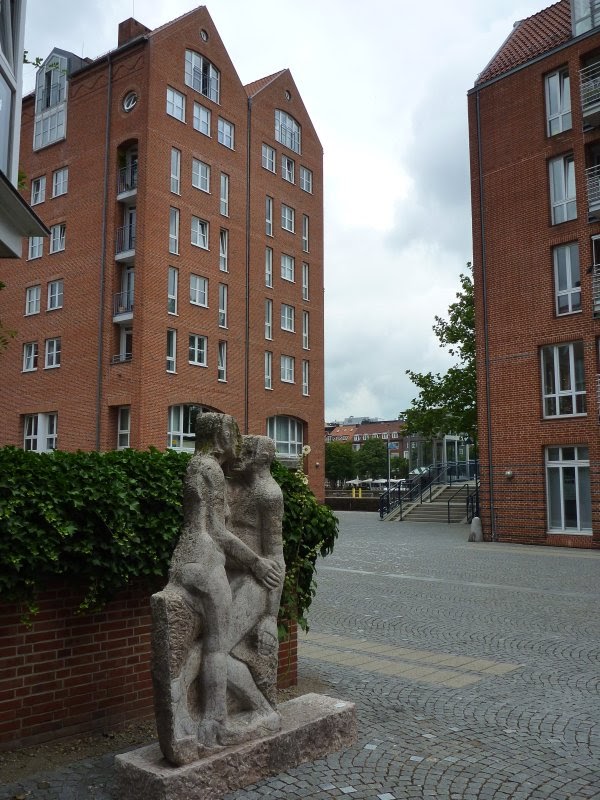
On the sculpture trail: “Pair” by Mareike Seegers in Bremen's Teerhof district


Bremen's Teerhof district is just a few steps away from the Schlachte. A walk over the pedestrian bridge (Teerhofbrücke), crossing the Weser river, gets you to the Teerhof “peninsula.” The sculpture “Paar” (meaning pair in English) by Mareike Seegers is located next to the pedestrian alley along the peninsula axis between the modern red-brickstone buildings.

The compositum Teerhof literally means tar court. In the past, ships were here tarred and equipped with what ever it needed to make them sea-going. The historical district got mostly destroyed during World War II. Today's Teerhof, reconstructed with the historic architecture in mind, combines apartment and office buildings—and art. Teerhof's “Neue Museum Weserburg” (The Museum in the River) is a modern art museum, which opened in the year 1991 and is collecting and presenting international and contemporary art.

More about the artist and her work
[1]
Paar von Mareike Seegers (1998) - auf dem Teerhof: http://fotos-bilder.de/Bremen/neustadt/page-0009.htm.
[2] Künstler - Mareike Seegers-Herenda: http://www.atelier-brandt-credo.de/seegers_herenda.html.

Tuesday, December 7, 2010

River walk in northern Germany: Bremen's Schlachte


The city of Bremen in northern Germany features river walks—promenades as well as bike trails—along the Weser river. The paths and trails pass the downtown area and go beyond the city limits into the state of Lower Saxony. They are typically well-marked with signposts giving directions, location names and distances in kilometers (km).

Allthough Bremen is located about 50 km south from where the Weser meets the North Sea, the river through the city still experiences tides. Until the construction of the new port (the Freihafen) between 1884 and 1888, goods from overseas were shipped to the Schlachte, which is seen in the picture and now is a historical harbour destrict with pubs (Biergärten in summer), businesses and landing sites for theater, restaurant and tourist boats.

Two information boards, one in English and one in German, explain that the original structure of die Schlachte did not survive World War II. Major renewal work has been done at the end of the last century and the Schlachte was reopened in 2000. For over six hundred years this was the harbour of the Hanseatic League port Bremen. Beginning in the eighteenth century, however, sea-going ships couldn't access the Schlachte due to natural silting processes in the Weser. This didn't stop commercial activity and trading. Barges were carrying goods along the final river stretch to town.

Getting there
The Schlachte is located between the Wilhelm-Kaisen-Brücke and the Bürgermeister-Smidt Brücke (two bridges). From the city hall (Rathaus), stroll across the market place and through the narrow Böttcherstraße. At the end of this lovely alley you'll find an underground passage leading to the boat tour terminal (Martini Anleger, next to the church, Martinikirche, in the picture). The Schlachte is to the north. You can walk on different levels. The lower level is occasionally flooded when high tides and winter storms converge.

Wednesday, November 24, 2010

On the sculpture trail: curved horns, flutings and spirals


This sheep head with beautifully curved horns, flutings and engravings belongs to a bronze sculpture located at the entrance of the McKinley Park School in Reno, Nevada. A floor panel informs:
Artist: Brad Rude
Sheep Name: Mountaintop
Sponsor: SBC Nevada Bell
Donated to: The City of Reno

As the spiral on the neck of the nude sheep indicates, this creation is more than a sculpture. Mountaintop's surface is enamel painted with abstract motifs as well as real ones such as a mountain lion head (I think it is) and a man in a boat. Brad Rude incorporates other animals (dogs, horses, cows, rhinos and lion), wildlife and nature in his sculptural fantasies and paintings.

Getting to the McKinley Arts & Culture Center
From I-80, take the Keystone exit, drive south on Keystone Avenue and go past its intersection with Fourth Street. You'll see the Center to your left, just before Keystone continues on over the Truckee River. Address: 925 Riverside Drive. The Center and its parking lots occupy a city block bounded by Riverside Drive, Vine Street, Jones Street and Keystone Avenue. The sculpture stands in the entrance/courtyard facing south towards the Truckee River.

Thursday, October 28, 2010

Off the trail, through the air … ouch!


Truckee in California is getting ready for Halloween. Wizards and witches keep flying in. But flying into Truckee can be tricky. This witch took an unexpected path and got stuck. By looking at her boots, you can tell that hiking wasn't her thing. At least, she found a nice look-out spot—but, my guess is, her glasses are broken, if nothing else.

Where else does one want to get stuck, if not in Truckee?

Getting there, finding her
Go to the intersection of Donner Pass Rd and Bridge St in central Truckee. Look around for the party (actually a line) of white ghosts. That's where the pole dance on a broomstick is happening. You might discover other curiosities as well.

Sunday, October 24, 2010

At the edge of the Truckee River canyon along the Sawtooth Trail

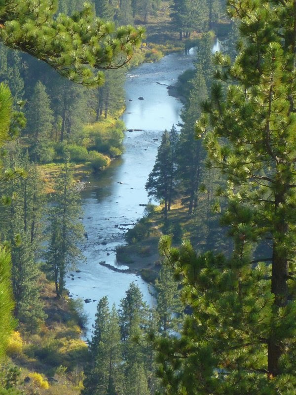
The Sawtooth Trail is located in the Tahoe National Forest south of Truckee in California. I am not sure if the trail is named after the many U-curves along its path or after some of the tooth-shaped rocks at the edge of the Truckee River canyon. Anyway, there are nice views from the canyon edge of the trail. Other sections of the trail loop through Jeffrey pine and white fir forest and manzanita areas. Mountain bikers love the curvy nature of the trail.

Getting to the trailheads
From the intersection of Donner Pass Road and Bridge Street in downtown Truckee, drive south on Bridge, cross the railroad track and continue until the road bends eastward and continues as Brockway Road. Turn right at Palisades Drive, which continues as Ponderosa Drive by making a slight left turn. Pass Pine Cove Road to your right and then take Silverfir Drive. Go west for less than half a mile and turn left at Thelin Drive. After 0.1 mile take 06 Fire Road on the right, pass the steel gate and drive to the beginning of the dirt road, where you'll see the first parking area and trailhead. There are other Sawtooth Trail access points further south, which you can reach by car if you follow the dirt road. The trail itself is a well-marked single-track trail.

Maps and trail review
[1] Map with Truckee dirt trails: http://www.truckeetrails.org/trails.php?TrailID=11&type=Dirt.
[2] Sawtooth trail: http://www.yelp.com/biz/sawtooth-trail-truckee.