The
Point Reyes Lighthouse stands on a small platform on top of
windblown rocks. Expect
salt-spray and
fog. In this harsh environment only specialized plant species survive. An interpretive panel tells us:
The wife of a lighthouse keeper once planted a small garden nearby, but with no success. As soon as the carrots sprouted the wind blew them away. Few plants can face up to the ocean's harsh influences.
On a foggy morning, your approach to the
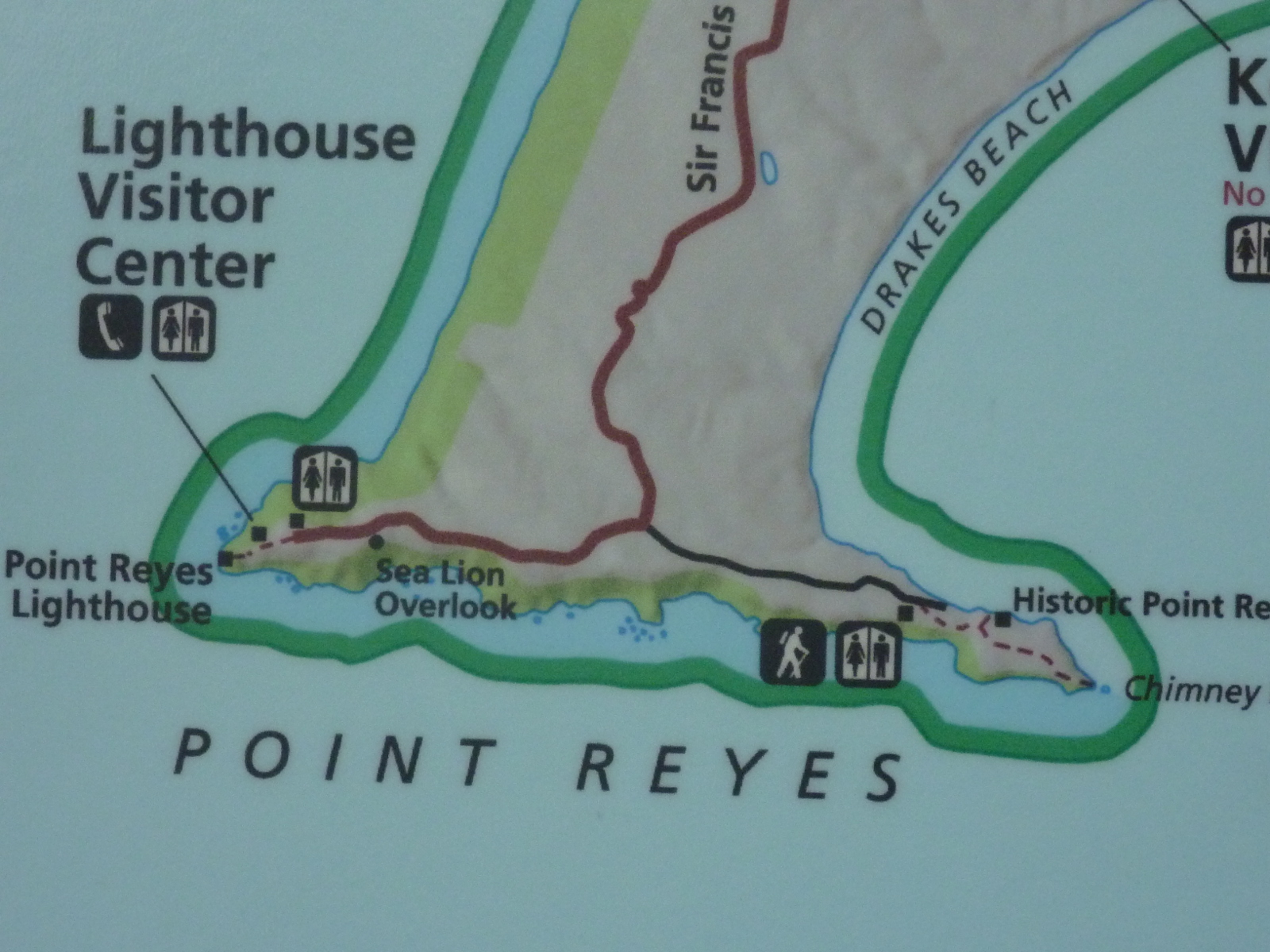
Lighthouse Visitor Center may include a short walk under
water-dripping cypresses.
 |
| Fern plants growing on branches of wet cypresses alongside lighthouse trail |
On an outside wall at the visitor center, you will find an offshore map showing the
undersea topography of the
continental shelf with
Cordell Bank,
Rittenburg Bank and
Noonday Rock.
 |
| Skull of a gray whale |
On their spring migration,
California gray whales (
Eschrichtius robustus) pass Point Reyes close to shore and—when the fog lifts—you can see spouting whales breaking through the ocean surface over the shelfscape. The
skull of a female gray whale, found in February 1985, is on display next to the
Point Reyes Conglomerate peak.
After passing the conglomerate outcrop, you will find yourself on top of the stairway with 300-plus steps. The stairway sometimes is closed when winds are getting too strong to descend/ascend safely. Gusts exceeding 100 mph have been recorded. A panel summarizes the lighthouse history:
Point Reyes Light has guided and cautioned mariners along this hazardous coast for over 100 years. Built by the U.S. Lighthouse Service in 1870, it came under management of the U.S. Coast Guard in 1939. Resident personnel operated the station until 1975 when the conversion to automated lights and electronic equipment was completed.
The National Park Service maintains a very detailed
Visit the Point Reyes Lighthouse site, which further highlights the lighthouse history and links to information on accessibility and road-closure/shuttle-bus policies during
whale-watching season.
Getting to the lighthouse trailhead
From
Olema or the
Bear Valley Visitor Center, drive north on
Bear Valley Road and turn left at its junction with
Sir Francis Drake Boulevard. Follow Sir Francis Drake Blvd. for about 20 miles to its end—first northwest along the western shore of
Tomales Bay to
Inverness, then westward over the
Inverness Ridge and finally southwest through the
Pastoral Lands.
Don't miss Chimney Rock!
Returning from your lighthouse visit, you may want to explore the east-side spur of the headlands by hiking through grassland, enjoying views of
Drakes Bay and overlooking surf-zone rocks such as
Chimney Rock and the
natural bridge at the end of
Chimney Rock Trail. To do that, turn right on
Chimney Rock Road (before passing again through the
“A” Ranch). Find the parking lot and trailhead after about one mile from the
Sir Francis Drake Blvd./Chimney Rock Rd. junction.
See more: Point Reyes National Seashore, California.


No comments:
Post a Comment