 |
| Upper Waterfall in North Kings Canyon |
 The Kings Canyon Waterfalls are a series of falls cascading down North Kings Canyon west of Carson City, Nevada. The most scenic sites: the lower waterfall accessible via the 0.3-mile-long, hikers-only Waterfall Trail off Kings Canyon Road and the upper waterfall (shown above), which is the main attraction of the 4.4-mile-long Upper Waterfall Loop—a trail open to hiking, mountain biking and horseback riding.
From the trailhead at the end of paved Kings Canyon Road go uphill on the dirt road. Enjoy the view of the land of the former Borda Ranch to your left. Manage those rough wash-outs along the dirt-and-gravel path caused by all the water rushing down the road and across it during rain storms of the wet 2016/2017 winter season. After climbing for a little less than one and a half mile, you will arrive at the south end of the Ash To Kings Trail. For the next 1.8 miles, this single-track trail coincidences with the Upper Waterfall Loop. Leave the dirt road behind and travel the less demandingly ascending single track.
A notice at the trail junction indicates that this is black bear and mountain lion habitat. A small herd of deer was crossing the trail further up when I came to a forested area. A mountain lion may have watched the deer. Most sections of the trail traverses sagebrush slopes featuring widely scattered pine trees, open enough to view spreading Carson City, the Virginia Range and the blue surface of Washoe Lake, which we missed last year.
 |
| View of Kings Canyon Road snaking eastward into downtown Carson City |
 |
| Curled leaves of tobacco brush (snowbrush) |
 |
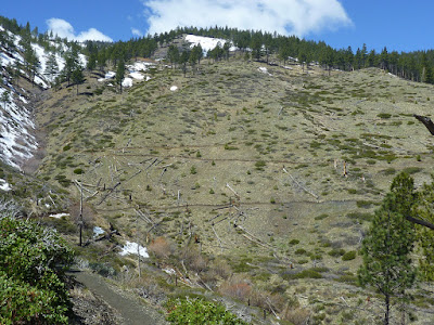
| Carson Range slope with switchbacks of the Upper Waterfall Loop trail |
Accessing the Upper Waterfall Loop
Get to the waterfall trailhead at the end of the paved section of Kings Canyon Road, as described at the bottom of my previous “Kings Canyon Falls: Waterfall Trail and North Kings Loop” post.
The trail map below gives a nice overview of the waterfall trails and the locations of the lower and upper fall.
 |
| Map with trails to the waterfalls of North Kings Canyon Creek |


No comments:
Post a Comment