Friday, August 26, 2016

A “relatively young” spatter-cone volcano: Black Crater

Trail sign for horizon-spanning Black Crater, Lava Beds 
Multiple eruptions from surface vents created most of the lava tube caves and spatter-cone volcanoes in what is now Lava Beds National Monumentthe land of burnt-out fires. Looking at the Lava Beds map, you may wonder what to explore first. Besides having many hiking options along various trails and trail loops, you may want to step down into some caves, such as Mushpot, Skull & Merrill caves, or walk around some spatter cones, such as the Fleener Chimneys. Another spatter cone, much younger then the three chimneys, is Black Crater—estimated to be around 3,025 years old, whereas the Fleener Chimneys are given an age of over 10,000 years (see William Hirt).

The rugged rim of Black Crater with fractured red-brown features
A level trail proceeds from the FS-10 roadside trailhead to a fork. To the left, a 1.1-mile-trail leads to the Thomas-Wright Battlefield—a historic site famous for a victory of the local Modoc people with their knowledge of the surrounding landscape over the US Army. The right-side fork takes you to the rugged rim of Black Crater, a short uphill hike of about 0.3 miles. Despite its name, you will see lots of red-brown patches. From the rim, your view will spin around the high-elevation, semi-arid desert lands inhabited for many centuries by the Modoc people.    

Getting to the Black Crater Trailhead
The “Black Crater Trailhead” is located about four miles north of the park's visitor center on the right side of FS-10. The parking strip there is the trailhead for the Thomas-Wright Battlefield Trail with access to the Black Crater. The massive spatter cone can be seen from the trailhead.


Thursday, August 25, 2016

The three chimneys at Lava Beds: Fleener Chimneys


Fleener Chimneys, land of burnt-out fires, California
The Fleener Chimneys are volcanic vents and spatter cones created by globs of lava. They are located in the Lava Beds National Monument park and are easily accessible via a short trail from a parking and picnic area west of FS-10.

A spatter-cone volcano forms from lava that is ejected from a vent. Active spatter-cone volcanoes are known from Hawaii. Their study helps earth scientists understand past events at Lava Beds. During a spatter cone event, a hurled-up lava fountain of very fluid particles (spatter) causes the formation of air-born lava clots that fall back to the lava surface around the vent and plaster themselves together to chimney-like structures.

Dragon's Mouth

From the turnout and picnic area, walk the short Fleener Chimneys Trail uphill. The first part is paved. Climb a few stairs to get to the Dragon's Mouth—a surface lava tube probably formed by low-viscosity lava channeling its downhill path underneath a hardened lava crust. While continuing your surface trip, you will arrive at an interpretive panel that describes the formation of the Fleener Chimneys as follows:

You are on a fault, a crack in the earth's crust, that extends for many miles. For nearly two million years lava has erupted periodically through this weakness., slowly building the Medicine Lake volcano [farther west]. Lava did not flow up through these chimneys, as you might suspect. Instead, it issued from a vertical conduit, much like water from a garden hose that is held straight up, and flowed downhill. You are standing on the hardened surface of that flow. The three chimneys were formed over the opening as thickened clots of lava were spattered higher and higher around it.
.  
You may want to climb around to get to and look into the chimneys, which are protected by metal metal railings and also protect you from falling in. Do not drop anything into the holes to keep the (once spoiled, now cleaned) chimneys unspoiled for future generations.


Getting to the Fleener Chimneys parking and picnic area
From the visitor center, drive north on FS-10. Pass the junctions with roads to Skull and Merrill Cave and Schonchin Butte. Find the marked road to Fleener Chimneys halfway between the Balcony Cave/Boulevard Cave area and the parking area to access the Black Crater and Thomas-Wright Battlefield trails. Head west until the road bends north and ends in front of the chimneys, about half a mile west of FS-10.

Searching for more?
William Hirt: Geology of Lava Beds National Monument. Department of Natural Sciences, College of the Siskiyous, 800 College Avenue, Weed, CA 96094 [http://www.siskiyous.edu/class/xnh0350/geology72guide2011.pdf].
Geotripper: Want to see classic volcano features in California? [geotripper.blogspot.com/2013/10/want-to-see-classic-volcano-features-in.html].
Trail Run Project: Fleener Chimneys [www.trailrunproject.com/gem/204].


Spatter-cone lava rocks of Fleener Chimneys

Saturday, August 20, 2016

Getting started with Lava Beds caves

Daylight flooding into Skull Cave
Lava Beds National Monument, dubbed the land of burnt out fires, has over 700 caves. Lava Beds park is a high desert wilderness. It can get very hot here in summer. You want to take cool dip? You can have it right here. The air temperature in the caves is about 55 °F (13 °C) year-round and the temperature in ice caves is even lower. There are caves to be entered via staircase or ladder. Each step downcave increases the physical chill. The handrails almost turn icy. Then, climbing up and out may give you some sort of a heat shock.

Mossy rocks at Mushpot entrance
A nice cave to start your hot-cold experience is the Mushpot. This 770-foot-long underground tube is only a 524-foot-walk away from the visitor center—where you should stop first to get informed about the diverse caves in the park and their various levels of challenge. The Mushpot has a relatively smooth, paved path. If you are tall, be prepared to duck-walk in some places. A hard hat may protect your head, but also makes you taller. While stepping down into the Mushpot hole you will notice the spongy and soft moss covering the surface of the upper-cave twilight zone. Inside the lava tube, you will walk along a lighted path guiding you through and back between narrowing walls and interesting formations—assisted spelunking

Don't expect other caves to be illuminated. Bring good flashlights. Skull Cave (2.4 miles from the visitor center) has a relatively large entrance. Daylight “lasts” for a while along the downhill path past its opening mouth (see top picture), but you need artificial lighting towards the tube's end to explore the ice floor. The cave is named for bones found inside: two human skeletons, bighorn sheep skulls and bones of antelope and mountain goats.

Staircase into Merrill Cave
Another cave with an ice floor is Merrill Cave (2.8 miles from the visitor center). Rather than being a cave of the dead, this ice cave has seen lively entertainment. Visitors in the early 1920s skated on its ice floor by lantern light. Today, global warming is dimming the chances of cave ice parties in the future. We learn this, while we come to recognize the projection put down on a panel at Merrill Cave's entrance:  

In 2000, Merrill Cave's massive, thick “ice rink”  began to rapidly melt. The more ice melts, the warmer the cave becomes. Consistently cold winters, along with rain and melted snow dripping from above, are necessary to sustain ice throughout the year. Though natural shifts in conditions play a role, you can now see the effects of global climate change in ice caves at Lava Beds. Average annual surface temperatures have risen about two degrees over the last six decades, while average precipitation levels have fluctuated greatly. These factors have contributed to a dramatic loss of ice in the majority of monitored caves. If trends continue, could the ice caves at Lava Beds someday lose all their ice? 
 
Global climate change can be monitored right here at Lave Beds. Or is it only a limited microclimate change in a remote area of northeast California?

References and more to explore
[1] National Park Service: Lava Beds Caves [www.nps.gov/labe/planyourvisit/upload./LAVA%20BEDS%20CAVES.pdf].
[2] The Path Less Beaten: Lava Beds National Monument  [thepathlessbeaten.com/2012/08/09/lava-beds-national-monument].
[3] Edward Brook, Lacey Little and Shane Fryer: A Preliminary Investigation of Cave Ice at Lava Beds National Monument, norther California [depts.washington.edu/pnwcesu/reports/J8W07100050_Final_Report.pdf].

Thursday, August 4, 2016

The land of burnt-out fires

Red-colored rock “glowing” before sunset at the fractured rim of Black Crater in Lava Beds National Monument park

The land of burnt-out fires is an area of northeast California that formed long ago, when flowing lava from volcanic eruptions cooled and shaped the landscape. Today, this is Lava Beds National Monument—a park of lava blankets, caves, catacombs, cones, chimneys and craters.

According to the park service hand-out, there is evidence of over 30 separate lava flows throughout the park. Multiple eruptions from volcanoes and surface vents created the current structure of holes, tubes, caves and underground labyrinths. The hand-out informs:

Eruptions occurring 30-40,000 years ago formed over 700 lava tube caves found in the park. Lava tubes form when streams of hot, flowing lava start to cool. The center of the stream stays hot and continues to flow as the outside begins to cool and harden. The hot lava drains out, leaving a pipe-like cave. Multiple eruptions can stack caves on top of one another, creating multilevel caves. When a lava tube ceiling collapses, it opens access to the cave below.

Entrance of Skull Cave, 2.4 miles north of the visitor center
Visitors to Lava Beds typically explore the park underground and between the rocks on its surface. Some of the 700 caves have inspiring names. Skull Cave with its wide and open entrance, for example, is named for the two human skeletons and bones of pronghorn, bighorn and sheep discovered inside. A special caving hand-out lists selected caves, classified as least challenging, moderately challenging and most challenging. In some caves you can walk completely upright, in others you may have to duck-walk or crawl in some places. Certain caves feature stairs you can use to step down and in. The cave or tube length varies from 150 to 7000 feet. The generally given advice: Cave softly and safely!  

Above ground, you will find short-and-easy as well as long-distance hiking trails leading to caves and other points of interest. The 9.4-mile-long Lyon Trail connects the Skull Cave area with Hospital Rock near Tule Lake Sump. The 7.5-mile-long Three Sisters Trail connects the Indian Well Campground near the visitor center with the Lyons Trail and provides for a loop hike of about eleven miles by including a section of the Bunchgrass Trail and the Missing Link Trail. The 3.3-mile-long (one-way) Whitney Butte Trail leads from the 
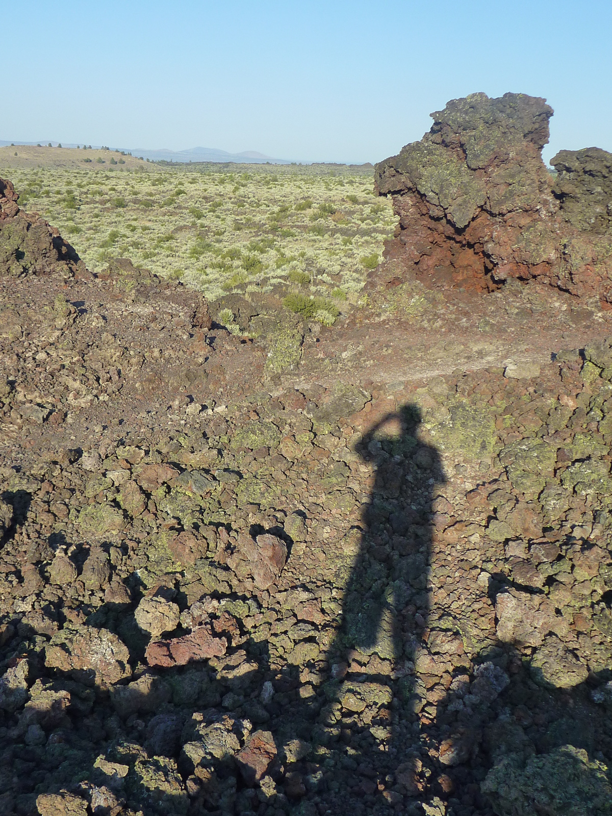
Merrill Ice Cave parking lots to Whitney Butte. A 1.2-mile-long (one way) trail from the Black Crater parking site provides access to the historic Thomas-Wright Battlefield between Hardin Butte and Black Crater.

The descriptive term “land of burnt-out fires” is derived from what the Modoc people called the lava-bed lands in their language. A perfect name—over 30,000 years of volcanic history compacted into a few words.The Modoc and their ancestors lived here for over 10,000 years. Some ancestor generations must have witnessed volcanic events; for example, the giant explosion further north that turned Mt. Mazama into Crater Lake. Or volcanic activity to the southwest including eruptions of the nearby Medicine Lake Volcano or in the Lassen Volcanic area. The ragged and rough terrain of the lava beds was, to generations of Modoc, a sacred landscape and a resourceful homeland.

Nature's glass: obsidian
Obsidian—nature's glass—shown along the path from the visitor center to the Mushpot cave