 |
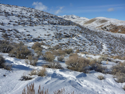
| Snow Terraces with Peavine mountain, Washoe County, Nevada |
From the Snow Terraces Trail's junction with Poedunk Trail at Trail Marker 37, the single-track trail traces its uphill path along a few switchbacks. The higher you get, the more spectacular becomes the panoramic vista including the Red Hills, Reno and the Virginia Range further southeast. Also, the northern end of the Carson Range with Mt. Rose is coming into better view. Once you have passed the ridge, marked by an inclining dirt road, you will see the other side of the recreational Peavine landscape: the background scenery of Peavine Peak concludes the wavy topography of hills, ridges and canyons. The north-northeast-facing Snow Terraces are just a few steps away. Climbing the “terraces” (actually, it looks more like a stepped hillside) by following the switchbacks, you will soon find yourself on the Halo Trail—at Trail Marker 47.
I am still waiting for the day, on which to observe a halo from this location; but in 2012 I found it to be a great spot for watching the solar eclipse.
 |
| Peavine mountain in winter, seen from the Snow Terraces |


No comments:
Post a Comment