Squaw Lake is a serene tarn terraced on granite southwest of popular Gold Lake in the Lakes Basin Recreation Area, north of the Plumas County line. Squaw Lake is beautifully surrounded by forest and rocks. In summer, the lake offers opportunities for refreshing dips and swimming—once you will have managed the small, slippery rocks and somewhat muddy ground at the water's edge.
Squaw Lake, in my judgement, shows structures of a cirque lake; formed at the head of a glacier—maybe an eventually separated branch of the great glacier that carved Gold Lake. The top photo captures a northeast view across the lake towards its lip with a narrow line of conifers, beyond of which the landscape opens to the lower basin of Gold Lake. The right-side picture shows north-east-sloping walls and cliffs that may have supported firn and head of a slowly downward moving glacier during ice-age times.
Getting to Squaw Lake
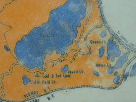
Get to Gold Lake west of the Gold Lake Highway (County Road 519) between Bassetts Station and Graeagle in Plumas County, California. There is a huge parking area and the Gold Lake Campground is next to it, touching the southeast lake shore. A gravel road between the shore and campsites leads southwest toward the boat ramp and to the end of the campground, where a rocky dirt road continues uphill. A dated area map is posted nearby. A sign—with a yellow “No Fireworks” square underneath—gives distances: Squaw Lake 1 mile, Gold Lake 4X4 1 1/2 mile, Little Gold Lake 2 miles and Summit Lake 3 1/2 miles. Hike the four-wheeling track for about a quarter mile and find the single-track shortcut that takes you to the junction of the jeep trail with the half-mile Squaw Lake Trail (sign below). Ascend this gravel-road trail, switchbacking over granite and through open forest with occassional views of Gold Lake. The road ends in the Squaw Lake bowl next to its west-side cliff slopes.


No comments:
Post a Comment